This poem is by Megan Mendivil, daughter of my ALC cyclist representative, Russ Mendivil, who is the author of The Ride: How to Ride Your Bike from San Francisco to Los Angeles Without Even Dying.
It's the week before Christmas
All your shopping is done
You are ready for presents
You are ready for fun
During this season
You probably think
About all that you have
And how life doesn't stink
You might think about family
Your nino and nina
Your crazy aunt Mildred
And drunk cousin Tina
Or your mom and your dad
And your sisters and brothers
But have you considered
Doing something for others?
I have an idea
For you to help out
To make a big difference
Without any doubt
You could make a dontion
Help stop HIV
Help people with AIDS
Support ALC
I will be riding
My bike to LA
June 6th through the 12th
It's a really long way
Please visit my webpage
It's listed below
And make a donation
Give some holiday dough.
The $19 video show
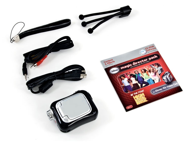
I suppose it's some mark of progress that a reasonably full-featured color video camera is now sold as a $19 Disney-branded "toy." In my ongoing quest to chronicle the AIDS/LifeCycle experience, I recently plunked down the $19 to see just how far we've come.
The answer is that we've come quite far. This little box is smaller than a 3x5 index card and delivers full-size video with crisp color. It's not perfect (for $19, it's not expected to be), but it's certainly serviceable.
So, for a test, I attached the camera to my headlight bracket, mounted it on my handlebar, and took off for a short ride into nearby Shoreline Park and into Palo Alto. I've sped up the video by approximately 6x (and I've reduced the image size for uploading to YouTube, so don't try to watch it full-screen), so the lack of image stabilization is noticeable, but other than that, it's amazing what a tiny little box stuck to the front of a bicycle will do these days.
If you're from here, you can use this as a guide to navigate through the twisty mess of unsigned/unmarked trails in Shoreline. If you're not from here, this is an example of what's available just 1.5 miles from my front door ... and in mid-December, at that. Watch out for the ducks!
Ride report: Loop around the South Bay (12/13/2009)

Despite the light shower that moved through Mountain View right before ride-out time, we were extremely fortunate to be totally rain-free on today's 41-mile ride. The four brave riders who took a chance were rewarded with fresh air, low traffic ... and a small flood! The bicycle approach to the eastbound Dumbarton Bridge was under more than a foot of water, and we had to take a long walk along a very muddy levee to get around it, thus fouling our shoes and our bicycles.
Although the skies looked threatening all day long, we somehow managed to be in exactly the right place at the right time, as showers that were to the west of us magically disappeared and then reappeared to our east. But because of the wet pavement, our bicycles all were considerably dirty at the end -- I've already cleaned mine; be sure to clean yours.
This was my last official ride of 2009. I'll be back on Jan. 9 with the beginning of the Cat-3 Distance Training rides. Between now and then, I'll be planning those rides, and I might show up at some of the other rides happening around the area.
Ride report: Cupertino and Los Altos (12/12/2009)
We did it! Eight intrepid (and perhaps slightly crazy) riders completed 21 rainy miles this morning. We were all in such a hurry to get back into our warm vehicles that I didn't get to take a group picture at the end.
And, miraculously, nobody had any flats during the ride!
Remember that we will try to run our 41-mile loop ride tomorrow morning. Again, the weather is still iffy, but I'll try to make a ride/no-ride decision by 8 a.m. and post it here.
And, miraculously, nobody had any flats during the ride!
Remember that we will try to run our 41-mile loop ride tomorrow morning. Again, the weather is still iffy, but I'll try to make a ride/no-ride decision by 8 a.m. and post it here.
Jeyakumar (Kumar) Shanmugam, 1959-2009 (updated)

According to multiple reports on Facebook, ALC rider Kumar Shanmugam died Tuesday, although I have no information on the circumstances.
Kumar was a regular participant in Mountain View and Sunnyvale training rides. He was seriously injured in spring 2008 during a training ride from King City to Quadbuster and was unable to ride in ALC7, but he recovered and returned to training rides later that year.
He was the director of engineering at Cypress Semiconductor, and he was married. My condolences to Kumar's wife, family, and friends. I will miss his enthusiasm.
In memory of Jeyakumar Shanmugam, the memorial service will take place at 12:00 noon on Tuesday, December 15, 2009 at First Unitarian Church of San Jose, 160 North 3rd Street, San Jose, California 95112. A reception will follow at a reception hall adjacent to the church.
Parking is available at the 3rd Street Parking Garage, located on the corner of North 3rd Street and East Saint James Street, If using lightrail, use the Saint James Park Station.
His wife, Jenifer, has requested that in lieu of flowers, donations be made online in memory of Jeyakumar Shanmugam to The South Asian Heart Center Fund http://www.southasianheartcenter.org/
A minor change to California law
And it's a good one, too. Bike Nopa has the details:
Last month Governor Arnold Schwarzenegger signed into law a measure that makes legal what bicyclists have been doing all along: riding across Masonic Avenue on the Panhandle Path. No matter how carefully bicyclists shared the path with pedestrians and other cyclists and no matter that they only crossed the street with a green bike light before, they were still breaking the law. The problem was with the interpretation a law that governed use of the crosswalk. The previous wording of the law allowed an interpretation that cyclists should get off their bike and walk across a street like Masonic.
... Senate bill 734 (in pdf here), introduced by Senator Alan Lowenthal, rectified the problem by defining a "bicycle path crossing" as any portion of a roadway clearly marked and indicated for use by bicyclists. In other words, bicyclists have the right to use the bicycle paths designated for their use even when the path crosses a street that connects segments of the route.
Ride report: Saratoga via Mt. Eden (12/5/2009)

Go, riders!
The almost-winter chill definitely was in the air today for our intrepid group of 20 riders on our 33-mile ride. From the remote quiet of Stevens Canyon to the busy streets of Cupertino and Sunnyvale, we experienced a good sample of the many different types of riding we'll see on the event in June.
Special congratulations to those of you who conquered Mount Eden for the first time. That climb is typical of many of the intermediate climbs you'll find throughout the training season and in June. Everyone has their own speed; never feel pressured to keep up with anyone else. The same applies on the descent: Just because an expert hill master flies by you, don't feel the need to get in behind them -- especially if you're unfamiliar with the road. And if any climb is just too much for you for any reason (maybe it's just not your day), never be ashamed to walk some or all of the hill. Those of us who did ALC8 this year were faced with an extremely steep hill (which may or may not be part of the ALC9 route) outside Pismo Beach on Day 4, and many of us chose to walk. Always listen to your body, and don't needlessly put yourself at risk of injury.
Part of keeping your body healthy is proper nutrition. Now that our rides are more than two hours long (yes, even for the faster folks), you can't complete a ride without proper energy before, during, and after the ride. For morning rides, a good breakfast is essential, about an hour before ride-out. And it's important to take in calories during the ride, either at scheduled rest stops or on your own. Check out the guidelines on nutrition and hydration at the ALC website. And a quick note: Don't forget to drink, especially during winter. In colder weather, we're often less tempted to hydrate while riding, but the need is still there.
 And as always, a few lessons were learned along the way today ... including by me.
One of our riders went down today, and we were very lucky that nobody was hurt. The bad part is that I was at least partially to blame. As we approached the tricky left turn from Quito onto Cox, I was leading a group of riders who were moving along at a rather strong pace -- about 18-20 mph. I saw the small "Quito Center" sign that was marked on the route sheet, and I called out, "Left turn!" The problem was that we were already at the beginning of the left turn lane, and there was a lane of traffic between the bike lane and the turn lane. I called, "Slowing!" and quickly made it to the head of the left turn lane, but I had failed to announce my intent early enough, and some of the other riders in the group weren't prepared to make the turn. One tried to come across -- and went down in the process at a slow speed ... but right in the middle of the through-traffic lane. Fortunately, the approaching car stopped! And also very fortunately, the rider was not injured. But my error was clear: I should have announced my intent earlier. And since I did not, the proper action was to continue past our designated turn to the next intersection, where we could have made a safe U-turn and returned to the route.
Another error I made today was at the intersection of Cox/Wardell and Saratoga-Sunnyvale. Our route took us through the intersection, and I correctly stopped behind the limit line and in the through lane (not the turn lane) ... but I failed to stop on the painted bike sensor to trip the traffic signal. In a situation like that where a bike sensor is clearly indicated and no car is already on top of the sensor, the proper action is to move to the sensor, which is usually in the middle of the lane. Thanks to the rider who gently reminded me of my error!
 I was very pleased to hear lots of "Car back!" today. When you hear it behind you, always pass it forward in your line of riders. And if the car turns or stops before it reaches you, don't worry -- it's far better to have given an extra warning than to not have given one when there really is a car back.
What's next? Next Saturday (Dec. 12), we are scheduled for a 41-mile flat loop around the South Bay. The weather might have other plans for us; the storm that's approaching is already putting news outlets on high alert with phrases such as "biggest storm in the past seven years" and "the storm door is open" even to "these storms could end our drought." The current long-range forecast for next Saturday (which, of course, is more of a guess than an actual forecast) calls for showers throughout the day. However, the ride is "heavy rain cancels," which means that mere drizzle or light showers won't cancel the ride. (And because our route is almost completely flat, we don't have to worry about tricky technical riding in the rain.) Getting at least some experience riding in the rain is strongly recommended because rain can happen during the event in June, and we keep on riding unless the storm is of epic proportions (as it was this year on Day 6). Lots of things change in the rain -- how your brakes work, how your wheels grab the pavement, how well your sunglasses repel (or don't repel) water, how much water soaks into your saddlebag, and other things you might not have considered.
I'll post updates here as needed throughout the week, and next Saturday morning, I'll make a ride/no-ride decision as early as possible, hopefully by 7 a.m., and post it here. Details and RSVP are here.
Don't forget the ALC9 Northern California kickoff party, scheduled for Sunday, Jan. 24 in San Francisco. This is one of the major events of the season, and there's a new location this year: Mezzanine. Thousands of dollars in prizes are promised, which probably will include the usual assortment of new bicycles. Details and RSVP are here.
Thank you for riding today, and thank you for being part of AIDS/LifeCycle.
Probably our last year at Franklin and Evelyn

Venturing somewhat off-topic from the world of cycling, this report from this morning's Mercury News is nonetheless important because, if these plans go as predicted, we're going to lose our longtime meeting spot:
Addressing neighborhood concerns about a proposed downtown affordable housing complex appeared to be a priority of the Mountain View City Council on Tuesday, as council members discussed design plans for the 51-unit apartment building at Franklin Street and Evelyn Avenue.
Council members picked the city-owned site at 135 Franklin St. in 2006 to develop as low-income rental housing for families. Last year, they chose Santa Clara-based ROEM Development Corp. to build the one-, two- and three-bedroom apartments and operate them under a long-term ground lease.
... After several more public meetings beginning in February, final approval on the project is scheduled for May 25.
Housing is, of course, more important than parking, and I'm not saying it's wrong ... just that I'll need to find a new place for us to meet in Mountain View starting next summer.
5,000 miles for 2009
With today's 35-mile World AIDS Day ride in the East Bay, I've crossed the magic 5,000-mile mark for this year. How does this compare to previous years? I hit 5,000 miles on these dates:
2009: November 29
2008: November 16
2007: December 16
2006: August 20
2005: October 21
My springtime maladies cost me a bunch of valuable training time during what should have been my highest-mileage period of the year. And, admittedly, there's the elusive "fun factor" -- the challenge of keeping cycling fun even though I've done nearly all of the popular nearby and convenient routes (at least the ones that are consistent with my skill level) so many times that the bicycle knows the way by itself.
That's one of the reasons why I traveled to Orinda for today's ride, and (more importantly for you) that's one of the reasons why the upcoming Cat-3 Distance Training rides won't be the same old routes from the previous two seasons. I'm still considering the possibilities, but there are definitely some interesting rides in store for us in 2010 as we get ready for ALC9.
Distance Training #2.5: Los Gatos (1/30/2010)
Rescheduled from Jan. 23
Date: Saturday, January 30
Meet time: 9:30 a.m.
Ride-out time: 10:00 a.m.
Meeting place: Three blocks west of the Mountain View Caltrain and VTA station, in the overflow parking lot at the corner of Evelyn Avenue and Franklin Street. (map)
City: Mountain View
Rain policy: Heavy rain cancels
Category: 3 - moderate-fast pace (12-15 mph)
Terrain: 2 - rolling hills
Miles: 45
Description:
Even if you missed the first Cat-3 Distance Training ride in early January, it's not too late to join us.
The Cat-3 Distance Training rides are for intermediate and advanced riders who want to increase their physical and mental endurance on long-distance rides. This set of 10 rides gradually increases to a mid-May finale of a double metric century: 200 kilometers (125 miles) in a single day. These rides should be just one part of your overall AIDS/LifeCycle training program -- such as in conjunction with the weekly Cat-2 rides -- and are not sufficient by themselves to prepare for the event.
You do not need to be a super-fast rider to participate in these rides! Our experience has been that many cyclists taking part in Cat-2 training rides actually ride at a Cat-3 pace. And it's perfectly OK if you're at the lower end of the Cat-3 range; you do not need to be a 15-mph rider to do these rides.
We'll start by taking the gentle route to Saratoga (no Mount Eden) and then heading to Los Gatos. After that, we'll climb Kennedy Road east of Los Gatos in the easier direction, taking us briefly into San Jose, and then we'll return to Los Gatos along Blossom Hill Road into Monte Sereno. From there it's mostly downhill back through Saratoga, Cupertino, and Sunnyvale. Total climbing for this ride is about 1,900 feet.
Riders from all over Northern California are invited! Southbound Caltrain from San Francisco arrives at 9:29 a.m.
Leaders: Chris Thomas, Tim Huang, Kathy Sherman, Paul Vargas
 RSVPs are requested but not required.
 Distance Training #1: Woodside (1/9/2010)
Date: Saturday, January 9
Meet time: 9:30 a.m.
Ride-out time: 10:00 a.m.
Meeting place: Three blocks west of the Mountain View Caltrain and VTA station, in the overflow parking lot at the corner of Evelyn Avenue and Franklin Street. (map)
City: Mountain View
Rain policy: Heavy rain cancels
Category: 3 - moderate-fast pace (12-15 mph)
Terrain: 2 - rolling hills
Miles: 40
Description:
The Cat-3 Distance Training rides are for intermediate and advanced riders who want to increase their physical and mental endurance on long-distance rides. This set of 10 rides gradually increases to a mid-May finale of a double metric century: 200 kilometers (125 miles) in a single day. These rides should be just one part of your overall AIDS/LifeCycle training program -- such as in conjunction with the weekly Cat-2 rides -- and are not sufficient by themselves to prepare for the event.
You do not need to be a super-fast rider to participate in these rides! Our experience has been that many cyclists taking part in Cat-2 training rides actually ride at a Cat-3 pace. And it's perfectly OK if you're at the lower end of the Cat-3 range; you do not need to be a 15-mph rider to do these rides.
We start this year's rides with an easy confidence-builder that heads up Foothill Expressway past Stanford to Portola Valley. We'll take the back way into Woodside and then play around in the rolling hills there for a bit before heading down Sand Hill Road and back through downtown Palo Alto on the bicycle boulevard. Total climbing for this ride is about 1,700 feet.
Riders from all over Northern California are invited! Southbound Caltrain from San Francisco arrives at 9:29 a.m.
Leaders: Chris Thomas, Al Esquivel, Randy Files, Ellen Goldstein, Kevin Hunter, Mayor Bob, Bob Katz, Ally Kemmer, Larry L'Italien, Paul Rammer
RSVPs are requested but not required. Corrections and clarifications
The Cat-3 Distance Training rides will begin Saturday, Jan. 9, not the 16th as I mentioned earlier. Sorry about that!
Ride report: Portola Valley (11/21/2009)

Go, riders!
Sure, it was probably in the upper 30s when you woke up early this morning. But when the sun came out, things warmed up in a hurry. And even though the official temperature at the end of our ride was only 54 degrees, it certainly felt a whole lot warmer. The 20 intrepid riders on today's 29-mile training ride were treated to some fantastic late-autumn weather, and speeds were way up.
In fact, everyone on today's ride was riding at a Cat-3 pace (12-15 mph) or greater! And today's climbing was no slouch, either: On a mile-for-mile basis, there was about as much climbing today as you'll find on several days of the ride in June. And also just like June, some of that climbing was long and gradual, and some of it was short but attention-getting.
Everyone has their own style for dealing with each type of climbing, but the best advice I ever got for climbing -- and cycling in general -- comes from longtime ALCer Doreen Gonzales (ALC9 will be her 17th AIDS ride!), who said at the beginning of ALC6 that you always should ride in your "happy gear." What's your happy gear? For me, that's the point where I'm not overexerting myself, nor am I madly pedaling and bouncing my hips up and down. In technical terms, that usually translates for me to a cadence of about 80-90 rpm, even when climbing, but you can skip the technical part and just focus on when your body is telling you that it's happy.
 Another way that today was similar to June was in how quickly the temperature warmed up. Even in June, it's not unusual for us to begin our ride in temperatures below 50 degrees. What's different in June, however, is that on some days the temperature can get very hot, easily exceeding 90 degrees. That's why it's important to dress in layers, so you can remove, add, and remove clothing as conditions dictate throughout a long day in the saddle. For me, that usually includes leg warmers and arm warmers (although I wore a long-sleeve jersey today since I knew it wouldn't get all that warm) plus a light windbreaker that I can fold up tightly.
When to wear leg warmers? The experts disagree. Some say in temperatures up to 60 degrees; others say up to 70 degrees. Again, it's mainly a matter of personal preference and need; in my case, I had knee trouble a few seasons ago, so I usually want to keep them warm. I have two sets of leg warmers: one thicker (which I used today) and one lighter.
And here's some practical advice: Wear sunscreen. No, really. Even in winter. And reapply it often! As I write this, I'm nursing the tender early stages of a slight sunburn on my face and ears. Even though I put on sunscreen before we rode out, it was beginning to wear off by the end of the ride, and I didn't reapply any during the ride. Wrong! Especially if you're fair-skinned like me, sunburn can happen at any time of the year, particularly on the longer rides that we'll be doing in the weeks to come.
 A quick shopping tip: There's an ALC9 info meeting at Sports Basement in Sunnyvale on Tuesday, Dec. 1, which also happens to be World AIDS Day. They'll be showing the standard ALC video and signing up new folks, but here's the big draw for those of us already signed up: The increasingly rare 20% discount on everything in the store will be in effect that night. (That's more than the usual 15% ALC discount.) You can RSVP for the event here.
What's next for us? I'm taking the holiday weekend off, but I'll be back two weeks from today with a 33-mile ride to Saratoga and just a little bit beyond. We'll go through the extremely scenic (but possibly chilly) Stevens Canyon and tackle the significant 0.7-mile climb up Mount Eden. We'll have a rest stop in Saratoga and then head part of the way to Los Gatos before heading back. Details and RSVP are here.
Looking ahead to January, the Cat-3 Distance Training rides begin on
Also beginning in January are the Sunnyvale Cat-2 rides, facilitated by Randy Files and his group of leaders (many of whom you'll recognize from the Mountain View rides). These rides will take place every Sunday for about 18 weeks beginning in January and will slowly increase from about 25 miles to 100 miles. More details on these rides soon as well.
Have a happy holiday week, and thank you for being part of AIDS/LifeCycle.
Keeping an eye on the weather
Looks like we're expecting rain Friday and Friday night, but the current forecasts say Saturday should be OK. (Hmmmm, isn't that what they said last week as well?)
Based on the forecast, I'm still going ahead with plans for Saturday's ride to Portola Valley. And since this one is "heavy rain cancels," it'll take more than just a couple of light sprinkles to cancel the ride. Come on and join us!
Based on the forecast, I'm still going ahead with plans for Saturday's ride to Portola Valley. And since this one is "heavy rain cancels," it'll take more than just a couple of light sprinkles to cancel the ride. Come on and join us!
Ride report: ALC9 South Bay/Peninsula kickoff ride (11/14/2009)

Go, riders!
Welcome to the AIDS/LifeCycle 9 training season in the South Bay and on the Peninsula. This ride report goes out shortly after every ride that I facilitate between now and June. If I have a good email address for you, it'll show up in your inbox. If I don't (if, for instance, I can't read the sign-in sheet), all of the reports are posted here as well ... with photo enhancement.
We certainly started things off in grand style this morning with 33 intrepid riders who braved a very unexpected -- but mercifully brief -- heavy rain shower on our 22-mile ride from Mountain View to Cupertino. Along the way, we learned a surprising number of things about getting ready to ride in ALC.
In most cases, the ride in June goes on rain or shine. (The ride this past June was a notable exception, when conditions simply were too hazardous to safely continue. But that's a story for another time.) And since much of our ride is along the coast, drizzle or light rain really can happen at just about any time of the year. Day 1 of the ride is notorious for thick fog that sometimes turns into drizzle as we head south out of San Francisco. Even if you don't like riding in the rain, chances are that it will happen to you sometime, so it's always helpful to get some rain-riding experience before you have to do it with 2,500 other riders around you.
 What's different about riding in the rain? Mostly, it's just common sense. Slow down. Allow extra braking distance. Turn cautiously. Leave extra space behind the rider in front of you. Use your lights if you have them. Be on the lookout for car drivers who might not see you.
Flat tires happen more frequently in the rain ... as many of us (including myself) discovered today. That's because the wet surface allows all of the nasty little bits of road detritus to stick to your tires and wedge themselves in toward your tube. You can reduce your chances of going flat in two ways: Slightly reduce the pressure in your tubes (by no more than 10 psi), and stop often to wipe the junk off your tires by spinning them and using part of your gloved hand to clean them.
Our training rides give you a chance to practice many of the skills you'll need on the ride on June. But there are a few additional skills that you need to make the most of training rides. One of these is learning how to read route sheets. Even though you'll get a route sheet for each day of the ride in June, the route is physically marked very well and packed with roadies to direct you. During training season, however, the routes are not marked with arrows or other indicators, and you need to study your route sheet so that you can avoid making a wrong turn.
Another thing that you'll find on route sheets for rides that I lead is an elevation chart for that day's ride. You'll notice that today's elevation chart had a scale of 110 miles distance and 2,000 feet of elevation, even though we did nothing close to that today. That's because this is the scale that you'll find on each route sheet during the ride in June, and this gives you good practice at gauging the relative difficulty of a ride.
 Many short but significant hills barely register on an elevation chart of this scale ... such as today's short climb up McClellan Road in Cupertino. Here's a magnified view of part of the elevation chart. See the bit circled in red? That's the hill on McClellan! At actual size, you probably didn't even notice the little bump in the elevation line.
 The ride in June typically has about 20,000 feet of climbing spread out over seven days. While there are some long climbs almost every day, there are countless little hills like this one that aren't very long but certainly can be attention-getting, especially after you've been on your bike for days. If (like me) hills aren't your favorite thing, just take them at whatever speed is comfortable for you -- and don't be afraid to walk part or all of one if needed.
Before today's ride, I talked at great length about the importance of safety and following the AIDS/LifeCycle code of conduct. By and large, your ride leaders were quite pleased with what we saw today. A couple of notes from the road, however. First, when someone calls out "on your left" and is starting to pass you, try to move over as far to the right as safely possible to give the other rider room to pass. This is very important in June because chances are that you will pass or be passed dozens of times each day. Second, although the ALC safety rules don't specifically say anything about prohibiting photography while riding, that's something you probably shouldn't do in most cases, especially in hazardous conditions like this morning's rain.
And I'll close for today with a few words about that rain. My apologies to each of you; I honestly didn't expect that we'd get rained on, especially to the extent that we did. But this gives me an opportunity to talk about our rain-cancellation policy. Most training rides are marked either "rain cancels" or "heavy rain cancels." Generally, light drizzle doesn't count as rain. Depending on when you rode through Cupertino this morning, the rain you experienced was somewhere on the dividing line between "moderate" and "heavy." When there's a chance of rain, the ride facilitator tries to make a good call as early as possible so that you'll know whether the ride is on or off. The decision is based not just on the forecast but also on where we'll be riding on any given day; for example, twisty, narrow mountain roads are more dangerous in the rain than are quiet residential streets.
If rain happens during a ride, the ride leaders confer to decide how best to proceed. After talking with most of you today, we decided that with only 9 miles left and improving skies, we'd continue with the rest of the ride. And sure enough, it was sunny by the time we got back to Mountain View. Sometimes, however, ride leaders might take riders back to the meeting point via a shorter route that isn't part of the designated route. When rain breaks out on a training ride, it's often best to wait at the next rest stop until a ride leader shows up. (Of course, if the conditions are too dangerous and no rest stop is nearby, stop at the next safe place and wait for the weather to clear.)
 On a ride morning when weather is an issue, I'll always post updates on my training blog and my Facebook page; please check there before calling me. If we do cancel a ride, a ride leader will always be at the meeting location at the designated time, usually with route sheets for anyone who still wishes to ride unofficially. Such rides are by individuals, however, and are neither organized nor sanctioned by ALC. (End of legal stuff.)
What's next? I've got three more Mountain View rides coming up before the end of the year. Next Saturday, we'll be riding 29 miles to Portola Valley around the Stanford loop. This is one of the most popular cycling routes in the nation, and we'll have plenty of company as we tackle the rolling hills. All of my rides meet at the same place as today's ride, and you can find out more and RSVP here. Other rides from Mountain View will be on Dec. 5 and Dec. 12, slowly increasing to 41 miles.
We have a fun and challenging training season ahead of us, I look forward to riding with you, and I thank you for making the commitment to be part of AIDS/LifeCycle.
Moffett Blvd. in Mountain View
If you've been in Mountain View lately, you might know that there's a repaving project in progress on Moffett Blvd. near downtown -- which just happens to be part of our scheduled route for this Saturday's kickoff ride.
Not to fear, I think; all of the signs indicate that paving should be done by Friday. If it's not, we'll just take a slightly different route for the last mile of our ride, and I'll have a route sheet that reflects that if needed.
Update, Friday afternoon: The street was paved today! It's nice and smooooooth now.
Loop around the South Bay (12/13/2009)
Date: Sunday, Dec. 13 rescheduled
Meet time: 9:30 a.m.
Ride-out time: 10:00 a.m.
Meeting place: Three blocks west of the Mountain View Caltrain and VTA station, in the overflow parking lot at the corner of Evelyn Avenue and Franklin Street. (map)
City: Mountain View
Rain policy: Heavy rain cancels
Category: 2 - medium pace (10-12 mph)
Terrain: 1 - mostly flat
Miles: 41
Description:
Today's ride takes us across the Dumbarton Bridge and into Alameda County for a scenic, flat loop around the South Bay. And thanks to new streets and an old bike path that I recently rediscovered, the loop is now shorter than ever before!
From our starting point in downtown Mountain View, we'll ride along the bayshore and up University Avenue to the bridge -- which, incidentally, is our biggest hill of the day. (Never bicycled across the Dumbarton before? Most folks say it's not nearly as stressful as the Golden Gate.) After a short break in Newark, we'll head south along the other side of the bayshore, through Fremont and across marshlands, on our way to our second stop of the day in Milpitas. Next, we'll get on the Coyote Creek Trail and then follow an old bike path (just a couple of very small breaks in the pavement) for about half a mile along Highway 237. After that, we'll pass across the northern edge of San Jose and Santa Clara on our way to Baylands Park in Sunnyvale. We finish the day by riding along the edge of Moffett Field back into Mountain View.
Riders from all over Northern California are invited! Southbound Caltrain from San Francisco arrives at 9:29 a.m. Note that if you arrive via train or light rail, you'll need to walk three blocks northwest from the station, across Castro Street, to the corner of Evelyn and Franklin. The meeting place is not at the station itself.
Be sure to check the Training section of the ALC website for information on how to prepare for a training ride and what you must and should bring.
Leaders: Chris Thomas, Michael Casas, Al Esquivel, Kevin Hunter, Ally Kemmer, Linda Kemmer, Kathy Sherman, Margaret Vande Voorde, Paul Vargas (Not all leaders will be present for the rescheduled date)
RSVPs are requested but not required. Paving throughout unincorporated San Mateo County
Caution is advised through the end of December: The county is resurfacing many random streets and roads. The busy part of Alameda de las Pulgas from Sand Hill to Santa Cruz was being repaved yesterday, and work appears set to begin on lower Alpine Road. Work is also under way on part of Portola Road.
I tried to find a list of affected streets at the county's website, but I came up short. All I found was a contractors' project description, which didn't list any specific streets. The orange signs at the work sites indicate that the resurfacing program will continue through December 31. If you hit a street at the wrong time, you're likely to find pre-ground pavement that's very unpleasant for cyclists.
I tried to find a list of affected streets at the county's website, but I came up short. All I found was a contractors' project description, which didn't list any specific streets. The orange signs at the work sites indicate that the resurfacing program will continue through December 31. If you hit a street at the wrong time, you're likely to find pre-ground pavement that's very unpleasant for cyclists.
Charge cyclists a toll on the Golden Gate?
So there's again talk of possibly charging a toll for cyclists and pedestrians to cross the Golden Gate Bridge. Logistical nightmares aside, there's some interesting math running around the intertubes today. The original credit on this goes to John Holtzclaw of the Sierra Club.
The damage to roadways from motor vehicle traffic in the standard formula used by engineers is the speed x (axle loading) to the 4th power.
Speed on GG Bridge:
bicycle -- 10 mph
SUV -- 50 mph
ratio SUV/bicycle = 5
Axle loading:
170 lb person on 30 lb bike -- 200 lb
SUV -- 4000 lb
ratio SUV/bicycle = 20
20 to 4th power = 160000
So SUV damage = 5 x 160000 = 800,000
To be fair, bicycles should be charged the same rate as cars for the damage they cause. Charging bicycles 1 cent = $0.01 is equal to charging SUVs $8,000. If bicycles were charged 1 cent for every 10 bridge crossings, SUVs would be charged $800 per crossing. While there isn't an equivalent formula estimating pedestrian damage, if it is conservatively assumed to be 10 times that of bicyclists, a 1 cent charge to pedestrians is equal to charging SUVs $800.
Ref: Johnsson, R, THE COST OF RELYING ON THE WRONG POWER: ROAD WEAR AND THE IMPORTANCE OF THE FOURTH POWER RULE, Transport Policy, Volume: 11 Issue: 4 ; 10/00/2004
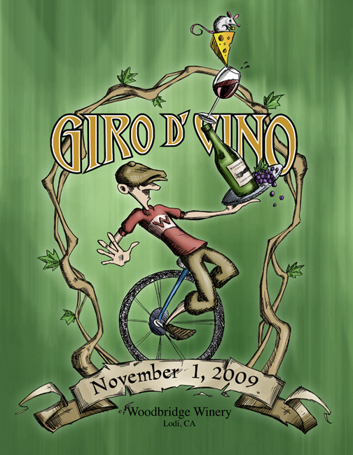
Ride report: Giro d'Vino (11/1/2009)

The headline of the day is that I completed a metric century in my fastest rolling time ever: six minutes faster than my previous best, which was set in Fresno in September 2005. Today's route was similarly almost-flat, although a couple of surprisingly "big" hills (which in reality weren't big at all) in the middle of the ride caught me off guard.
Starting in Lodi, it's a given that any ride will begin flat, flat, flat. And that's what today was, as we rolled out of the Woodbridge winery just a few minutes before the official start time of 8:30 a.m. (Many riders had left earlier, as I saw throughout the first part of the ride as I passed them.) A couple of 20mph-plus pacelines came by early, and I managed to hang on to one of them for something less than half a mile before deciding that doing so was just plain silly.
DSSF president David Gaus rode with me for the first few miles but then went off ahead on his own; he finished even faster than I did, although I finished first because I took less time at rest stops and even skipped some entirely. (More about that anon.)
 The nominal raison d'etre for the ride was to taste (and, hopefully, buy) a wide variety of wines from the Lodi region. The organizers had even arranged to ship riders' purchases to the finish line. As a result, the route was a convoluted zigzag whose main purpose was apparently to pass by as many wineries as possible. In fact, the official route sheet showed a whopping 61 turns on the route. Most were marked well (although David managed to miss a turn somewhere), but there was hardly any opportunity to get into a groove for any extended period of time. There were five designated "tasting stops" in addition to the two rest stops and one lunch stop. (And if you care, no, I did not partake of any tasting.)
The rest stops were, in a word, odd. The first "tasting stop" at mile 2.7 had its entrance blocked and a sign out front saying that the winery was "closed for the day." When I reached the first official rest stop at mile 21 at the Michael-David winery, there was nothing set up outside. I took a quick look inside and didn't see anything other than typical winery stuff and lots of tourist snacks available for purchase. I didn't feel like buying anything, so I quickly left and resumed riding. (I was told later that there were indeed a few freebies such as half-bananas, but I didn't see any signage or people directing me to them.)
Lunch at Vino con Brio, on the other hand, was very well organized and very pleasant. The winery staff was making every effort to make us feel welcome, and they even had a duo playing live music in the courtyard. I almost wanted to buy a bottle just to thank them.
The route sheet said there were about 16 miles from lunch to the next rest stop -- the only real rest stop in the second 30 miles of the ride. Actually, here's what it said:
So I interpreted that as "turn right on Hwy. 12/88, go 0.7 mile, then turn left on Mackville, go 1.2 miles, and at the 'Y' with Jahant, there will be a rest stop."
At    Go   and Cycle on                       For
44.1  R    Hwy 12/88                          0.7
44.9  L    Mackville Rd                       1.2
46.1       Rest stop - Chocoholics            0
46.1  R    Jahant Rd (at "Y" merge to left)   0.6
Wrong. I made the left onto Mackville Road, but as soon as I did, I saw something looking very much like a very small rest stop (a couple of tables) on the right side of the road. I immediately concluded that this was a "bonus" rest stop and decided I didn't need it because the real rest stop would be just another mile up the road. Nope; that was the real rest stop, and when I reached the "Y," I realized that I'd blown by my last chance for food, water, and portapotty.
That wasn't the only route sheet fart of the day; there was this little sequence, too:
Perhaps I'm just becoming too picky about my route sheets! The result was that my ride ended up being 63.1 miles, not the 60.1 that was advertised on the route sheet. (Bikely said 61.7 miles.)
56.6  R   Woodbridge Rd            0.3
56.6  R   Buck Rd                  0.5
 But since I missed the last rest stop, I had to make a brief unscheduled stop in the middle of nowhere to eat my emergency Clif bar, and I used the last of the Gatorade I'd taken at lunch. My speed also slowed a bit; my first 20 miles were in excess of 17 mph, but the rest of the ride was not quite as aggressive. Some of that was due to the poor condition of some of the roads we were on -- the chip-seal was old and had lots of ruts and sudden holes that were difficult or impossible to see. That's just the way things are in much of the Central Valley. But when we were on good roads with nice asphalt, my speed picked back up.
I rolled in to the end at Woodbridge in just a little under 4:30 of elapsed time and 3:55 of riding time, which makes me happy. After collecting my complementary winery glass (I got another glass from them last time I did a ride from there -- the Delta Century in spring 2005) and sampling the mediocre post-ride meal of pasta, salad, and bread (I declined the chicken) that's a staple of so many organized rides, I quickly changed out of my riding gear and made the 90-minute drive home.
That's my fill of Central Valley riding for a while; besides, today's near-perfect weather (temperature near 70 and very light winds) will be but a memory in that part of the state in just a few weeks when the fog settles in for the winter.
Absolute shortest South Bay loop
Thanks to new roads that have opened in the past year plus an old, largely forgotten bike path that's still in marginally usable condition, I've got the South Bay loop down to 41 miles, verified with a test ride. We'll use this route on our December 12 training ride.
Then, later in the season, we'll do the super South Bay loop ... a full 100 miles!
Then, later in the season, we'll do the super South Bay loop ... a full 100 miles!
Bay Area randonneuring events for 2010

The two main randonneuring (self-supported long-distance cycling) groups in the Bay Area have announced their 2010 event schedules, and they're good news for ALCers.
The main Santa Cruz Randonneurs schedule doesn't begin until late June, after ALC9 has ended. This is a big change from 2009, when all of the events were in the spring and conflicted with ALC training (and when most of us weren't yet in top form anyway). Of particular note is a 200km ride from Santa Cruz to Moss Beach that's scheduled for July 24 -- an almost-perfect time for ALCers, with just the right amount of post-ALC recovery.
And on August 21, there's a 300km ride from Santa Cruz to Greenfield that covers nearly all of our traditional Day 2 route -- and then comes back the same way, something we never get to do during the ride.
But if you're really
There's also a full year-long schedule of events from San Francisco Randonneurs, including a 200km ride to Point Reyes and back on January 24. Expect chilly, challenging, dark conditions for this one.
If you can handle the distance (even "just" a 200km ride), most ALCers should be fairly comfortable with randonneuring. The style is very similar to our training rides, and there's a genuine sense of camaraderie. There are generous time limits on each ride (13.5 hours for a 200km ride), but randonneuring is also very much a ride and not a race.
And a reminder: Mark your calendar for Saturday, May 15, 2010. That's when I'm offering the Third Annual Altamont Pass Double Metric, 200km from Mountain View to Altamont Pass and back, my final training ride for ALC9. Start training now, and you can do this!
Photo: My medal from the Chualar 200k in 2008.
News from the Day 6 route

One of the most beautiful parts of the ride is along the shore near Ventura toward the end of Day 6. (Those of you who rode for the first time in 2009 missed this!) But much of that part of the ride also happens to be on very busy, high-speed U.S. 101. The Ventura County Star reports that some changes are on the way in a couple of years, including a new separate bike path:
Caltrans plans to break ground in 2011 on a new carpool lane for Highway 101 as it passes Mussel Shoals, La Conchita and Rincon Point. The $151 million project will also include a bike path that is separate from the highway lanes, a new walkway under the highway between La Conchita and the beach, and the closing of the left turn lanes in and out of La Conchita and Mussel Shoals.
However, not all is rainbows and happiness. Some residents are unhappy about the possible loss of parking along the highway:
The residents’ biggest concern right now is the California Department of Transportation’s recent decision to move a bike path that’s part of the widening plan from the mountain side to the ocean side of the highway.
Caltrans officials say they would have preferred the bike path to be on the mountain side, but the California Coastal Commission asked them to move it because it wants to encourage development of a network of coastal trails that stretch from Oregon to the Mexican border.
Once construction actually begins, here's hoping that Caltrans keeps the existing bike access fully available. There's no other viable way into Ventura (just look at how the highway is wedged in between the ocean and the mountains), so this is an essential part of the ALC route.
Photo: Day 6 of ALC5
Saratoga via Mt. Eden (12/5/2009)
Date: Saturday, Dec. 5
Meet time: 9:30 a.m.
Ride-out time: 10:00 a.m.
Meeting place: Three blocks west of the Mountain View Caltrain and VTA station, in the overflow parking lot at the corner of Evelyn Avenue and Franklin Street. (map)
City: Mountain View
Rain policy: Heavy rain cancels
Category: 2 - medium pace (10-12 mph)
Terrain: 3 - rolling hills with some steep climbs
Miles: 33
Description:
After leaving downtown Mountain View, we'll head through Cupertino and then ride through the rolling hills of scenic Stevens Canyon. Next comes our significant climb of the day: the 0.7-mile ascent of Mount Eden out of Stevens Canyon. It's steep but not ridiculously steep, and you can always walk part or all of it. (Come back later this season to see how much you've improved!) We'll take a break in Saratoga Village and then go part of the way toward Los Gatos before heading back on an easy, mostly downhill route.
Total climbing for the day is about 1,550 feet.
Riders from all over Northern California are invited! Southbound Caltrain from San Francisco arrives at 9:29 a.m. Note that if you arrive via train or light rail, you'll need to walk three blocks northwest from the station, across Castro Street, to the corner of Evelyn and Franklin. The meeting place is not at the station itself.
Be sure to check the Training section of the ALC website for information on how to prepare for a training ride and what you must and should bring.
Leaders: Chris Thomas, Michael Casas, Kevin Hunter, Ally Kemmer, Linda Kemmer, Paul Vargas
RSVPs are requested but not required. Portola Valley (11/21/2009)
Date: Saturday, Nov. 21
Meet time: 9:30 a.m.
Ride-out time: 10:00 a.m.
Meeting place: Three blocks west of the Mountain View Caltrain and VTA station, in the overflow parking lot at the corner of Evelyn Avenue and Franklin Street. (map)
City: Mountain View
Rain policy: Heavy rain cancels
Category: 2 - medium pace (10-12 mph)
Terrain: 2 - rolling hills
Miles: 29
Description:
The Portola Valley loop is one of the Bay Area's most popular cycling routes, attracting everyone from novice riders to professional racers. Join us as we take a gentle route from Mountain View to Stanford and then tackle the long but very gradual ascent into the foothills. There are a couple of short, attention-getting hills as we head back toward Menlo Park, but after that it's all easy going on the Bryant Street bike boulevard through downtown Palo Alto.
Total climbing for the day is about 1,250 feet.
Riders from all over Northern California are invited! Southbound Caltrain from San Francisco arrives at 9:29 a.m. Note that if you arrive via train or light rail, you'll need to walk three blocks northwest from the station, across Castro Street, to the corner of Evelyn and Franklin. The meeting place is not at the station itself.
Be sure to check the Training section of the ALC website for information on how to prepare for a training ride and what you must and should bring.
Leaders: Chris Thomas, Tim Huang, Kevin Hunter, Mayor Bob, Ally Kemmer, Linda Kemmer, Ken Plough, Paul Rosas, Paul Vargas
RSVPs are requested but not required. Welcome to the new season

The AIDS/LifeCycle 9 season officially got under way this morning with kickoff rides in San Francisco and Los Angeles. And even though just four months ago I said I didn't know whether I'd be back ... well, I'm back.
I'm sure things will somehow be different this time; they always are. I'm hoping to have a smoother training season, although the early weather forecasts suggest that we'll be dodging rain for much of the winter and possibly into spring. I'm again looking forward to making new friends and reconnecting with veterans from past rides. And for me, that's a rather numbing thought -- at five years in ALC, that apparently puts me in about the top 15% of riders for longevity, and it means that I've now been around for more than half of all the ALCs. (That doesn't count the earlier California AIDS Rides, of course, and there are many folks who have been around far longer than I.) I've been more active in the preseason this year, helping teach this year's new classes of training ride leaders, and I skipped most of my traditional time off to lead a series of training rides for the recently completed Seismic Challenge.
Since I've already proven to myself that I can do this ride -- even when somewhat injured and in suboptimal health, as I was this year -- this clearly isn't about me meeting any physical challenge anymore. So why am I coming back? I'll admit that the social aspects have become an increasingly important part of my life. The year-round exercise is also important -- probably more than I realize as the years go by. But for all of the reasons why we ride, we share one common goal: to help fight HIV and AIDS so that the ride is no longer necessary.
To first-year riders and those considering joining us: Welcome aboard. This is a journey quite unlike anything else you've ever experienced. You'll experience just about every emotion in the book, and all of the videos, pictures, and words that you see about the ride really don't do justice to the unique experiences that you -- and only you -- will have.
To returning riders: Thank you for coming back. You already know how important the ride is, and your continuing involvement in the ride helps carry our message forward. And whatever kind of ride you had last time you did it, chances are you'll experience something completely different this time.
To my supporters: Giant thanks! I, of course, wouldn't be able to ride without your generous donations, and your support is more important than ever in these challenging times of drastic budget cuts. I know it's tough to be asked year after year to give what you can, and I'll again appreciate whatever support you can give the San Francisco AIDS Foundation on my way to reaching my $3,000 minimum and my $5,000 goal. (And if you can give sooner rather than later, that's a big help -- your money goes to work immediately, and it helps me stress out less about meeting my minimum.)
Thanks to all of you, and stand by for action!
Hwy. 84 at Alameda de las Pulgas

This letter appears in the latest edition of Gary Richards' column in the Mercury News:
Q There is a fairly big intersection at Alameda de Las Pulgas and Woodside Road on the Peninsula. If heading east on Woodside but wanting to go right at the Alameda, there is a bike lane and white painted markings that indicate that you should not get into the right lane until fairly close to the intersection. I can't tell you how many times cars speed by me in the bike lane. Is there a way to let these drivers know what the rules are?
Laurie Bassin
A Redwood City police get a ton of complaints about this behavior and say it is clear that only bicycles are allowed to travel on the right side of the roadway for most of the shoulder. They recently were out cracking down on these scofflaws and will likely make a return appearance.
This spot will be very familiar to Seismic Challenge riders as the site of Rest Stop 2 on Day 1. We also use it regularly on many of our Peninsula rides. It's a tricky spot because bicyclists usually are still moving along at a rather high speed after completing the mile-long descent from Woodside.
Back to normal in the Presidio

The Chronicle reports tonight that the traffic management experiment in the Presidio is ending earlier than planned:
Officials with the Presidio Trust, which operates the urban park, said Tuesday they gathered enough good information to shorten the test.
Several smaller road-closure tests, including the uphill portion of Crissy Field Avenue, will be reopened by Friday.
... The decision is welcomed by many neighbors who felt that choking off a major traffic artery leading in and out of the former Army base has been a big inconvenience.
This means that all of the usual routes will be available for our kickoff ride this Saturday.
Repaving on Bryant Street in Palo Alto

Two blocks of the "bike boulevard" are about to get a much-needed coat of fresh pavement. Ellen Fletcher (yes, the Ellen Fletcher of the "Ellen Fletcher bike boulevard" signs) says:
The prep work for repaving has started on the bumpy two blocks between Churchill and Lowell on the Bryant Street Bike Boulevard in Palo Alto :-)
The work is expected to last a couple of weeks.
From the map, you can see that simple detours are readily available.
PCH in Malibu

This report from Wednesday's edition of The Malibu Times likely will be of interest to ALCers. We're all too aware of the hazards along this part of PCH.
The most recent tragedy involved the death of Rodrigo Armas, 45, and serious injuries to his teenage son in June when Malibu City Clerk Robert Sam Sanchez allegedly struck the two as they were bicycling on Pacific Coast Highway. Sanchez, who is still employed by the city, has been charged with vehicular manslaughter, a DUI, and a hit and run resulting in serious bodily injury. He is scheduled for a hearing Oct. 20 at the Malibu Courthouse.
According to a state Office of Traffic Safety report, Malibu ranked No. 1 in total traffic victims killed and injured in 2005. The report, the latest ranking available, lists Malibu as the worst out of 104 cities in its population category based on daily vehicle miles traveled. Malibu was also the second worst city for victims killed and injured in alcohol-involved collisions; first in alcohol-involved collisions for drivers age 21 to 34; ninth for bicyclists killed and injured; first in speed-related collisions; and second in nighttime collisions, the report states. Calls to confirm 2006-2008 statistics were not returned by the California Highway Patrol.
... After the June 28 death of cyclist Armas, Thorsen said plans are in the works for a bike path along the highway to be constructed at the west end of Malibu. Additionally, the PCH Safety Task Force has resumed operation after a two-year hiatus. It will hold its next meeting on Jan. 7, 2010 in Santa Monica, at which the public is invited to voice safety concerns.
Giro d'Vino, Lodi (11/1/2009)
I'm signed up to ride 100km over in the Central Valley on Sunday, Nov. 1, in the 2009 Giro d'Vino.
It's a mostly flat route, but weather around there can be very unpredictable, and strong headwinds can make a flat ride very difficult. There's also the risk of early-season fog and drizzle, so a day of decent weather would be a very pleasant surprise indeed. (A 60km route is also available.)
This will be my first organized ride in the Stockton area since the 2005 Delta Century, which started at the exact same location. I'm familiar with most of the route, but it should be nice to see it again after a few years. There's a map running around Bikely that claims to be the 100km route, but it's almost totally flat. The organizers say that the route "includes some rolling hills of the Mokelumne River basin," so I suspect the unofficial map isn't accurate.
Registration is available online and costs $46.09 before the end of this Saturday. That includes the "processing fee" from active.com. If you use that website, be careful because active.com puts in all sorts of annoying upsells and opt-outs, trying to get you to pay on auto-renewal for magazines, subscription services, and memberships that you don't want. It's a sleazy practice, but they've apparently got de facto monopoly power and can do whatever they please. That still doesn't make me happy about it. (End of rant.)
ALC9 South Bay/Peninsula kickoff ride (11/14/2009)
Date: Saturday, Nov. 14
Meet time: 9:30 a.m.
Ride-out time: 10:00 a.m.
Meeting place: Three blocks west of the Mountain View Caltrain and VTA station, in the overflow parking lot at the corner of Evelyn Avenue and Franklin Street. (map)
City: Mountain View
Rain policy: Rain cancels
Category: N/A - This is a no-pace ride
Terrain: 2 - rolling hills
Miles: 22
Description:
Whether you're a first-time ALCer or a veteran rider, join us as we kick off another season of training in the South Bay and on the Peninsula. Meet new faces and reconnect with friends from past adventures on this mostly easy ride that goes ever so gently into the beginning of the foothills. We'll have plenty of ride leaders on hand to help you on the road, and we can help answer your questions about the ride, your bicycle, and the upcoming training season.
From downtown Mountain View, we'll head into Sunnyvale to begin our very gradual climb to De Anza College in Cupertino. Then we'll tackle our one hill of the day, westbound McClellan as it crosses Stevens Creek. It's very short but a little attention-getting, and it's perfectly OK to walk it. (In ALC, we call that "cross-training.") Then we'll ride on Foothill Expressway, a very popular bicycling route, to our rest stop in Los Altos Hills. After that, we'll continue into Palo Alto and then head back down near sea level for a flat return into Mountain View. Total climbing for the day is only about 550 feet.
Riders from all over Northern California are invited! Southbound Caltrain from San Francisco arrives at 9:29 a.m. Note that if you arrive via train or light rail, you'll need to walk three blocks northwest from the station, across Castro Street, to the corner of Evelyn and Franklin. The meeting place is not at the station itself.
Be sure to check the Training section of the ALC website for information on how to prepare for a training ride and what you must and should bring.
Leaders: Chris Thomas, Michael Cases, Eleanor Edralin, Randy Files, Tim Huang, Ally Kemmer, Linda Kemmer, Jamie Pereira, Ken Plough, Dennis Soong, Paul Vargas
RSVPs are requested but not required. Seismic Challenge 2.0: The weather forecast
Final update Friday morning
Over in ALC world, legendary rider Bob Katz has become known for posting advance weather forecasts before each year's ride. While I can't promise the same exemplary service as Bob, we're now within the two-week window where the weather forecasting services are starting to offer their predictions for this year's ride.
Here are specific to-the-hour predictions on what conditions will be like at each of the major stops, at the time most riders probably will pass through. There is currently no chance of rain anywhere along the route!
Of course, things can and do change, so take nothing here as certain. Also, the many Bay Area microclimates are notoriously tough to predict. But this information might help you prepare for what to pack and what to wear. My data comes from AccuWeather.
Day 1: Saturday, Oct. 17
7 a.m. in San Francisco: 59F, humidity 100%, wind WSW 5 mph, partly sunny (but sure looks like dense fog)
9 a.m. in San Bruno (RS1): 61F, humidity 93%, wind WSW 7 mph, mostly cloudy
10 a.m. in Redwood City (RS2): 62F, humidity 87%, wind N 2 mph, mostly cloudy
Noon in Fremont (lunch): 69F, humidity 85%, wind NW 6 mph, mostly cloudy
2 p.m. in Castro Valley (RS3): 68F, humidity 87%, wind W 9 mph, mostly cloudy
4 p.m. in Moraga (RS4): 72F, humidity 71%, wind W 8 mph, mostly cloudy
6 p.m. in Martinez: 70F, humidity 70%, wind WSW 8 mph, mostly cloudy
Day 2: Sunday, Oct. 18
7 a.m. in Martinez: 57F, humidity 92%, wind SSW 6, partly sunny
8 a.m. in Vallejo (RS1): 57F, humidity 94%, wind WSW 6 mph, partly sunny
9 a.m. in Napa (RS2): 58F, humidity 94%, wind WSW 5 mph, mostly cloudy
11 a.m. in Sonoma (lunch): 60F, humidity 86%, wind W 5 mph, cloudy
1 p.m. in Petaluma (RS3): 61F, humidity 79%, wind WSW 7 mph, mostly cloudy
4 p.m. in San Anselmo (RS4): 65F, humidity 68%, wind SW 10 mph, mostly cloudy
6 p.m. in San Francisco: 60F, humidity 74%, wind W 18 mph, partly sunny
Weekend changes to Caltrain schedule
I thought the weekend trains had been arriving at unusual times, and I was right. Turns out that Caltrain has modified its weekend/holiday schedule, and this could affect you if you take the train to any of our rides in Mountain View.
Trains that departed San Francisco on the hour now depart at 15 minutes past the hour. This means that the arrival time in Mountain View is now 29 minutes past the next hour. The earliest train of the day now leaves SF at 8:15 a.m. and arrives in Mountain View at 9:29 a.m.
Northbound trains back to SF appear to be unaffected, still leaving Mountain View at 19 minutes past the hour.
The change doesn't mess up this Sunday's ride, but it's worth noting for the future. Whenever I have rides that are train-friendly (those when the ride-out time is late enough), I'll be sure to accommodate the new train schedule.
End of another training season

In October!? Yes, it's the end of the Seismic Challenge 2.0 training season, and I've been proud to help many of you train for this year's ride, which begins two weeks from today in San Francisco.
Each of the nine riders on today's 87-mile ride did fantastic, with everyone riding well above the pace necessary to complete both days of Seismic Challenge. We were helped by remarkably moderate temperatures -- not getting much above 70 degrees if at all -- and winds that didn't really pick up until the last few downhill miles.
I think the most important lesson to take away from today's ride is a lesson that I've talked about before: pacing. We started off today's route with 50 fairly easy miles, and just about everybody rode those 50 miles at an average speed of 15 mph -- way fast by our standards. Toward the end of the day, I could see a few folks slowing down (including me). The trick is to keep some energy on hand to deal with late-day hills and other unexpected events, even when there's a strong temptation to ride all-out on flat terrain. Remember, it's not a race.
I'll see all of you in two weeks on Day 1 of Seismic Challenge. Since you folks are so speedy, I'm sure you'll pass me, so say hi as you call out "on your left." (I'll be wearing my ride leader jersey and the socks. Can't miss me!)
It's been an honor to ride with you, and I commend you for your support of the San Francisco AIDS Foundation.
Photo credit: Susan Fish
Fire season on the SC Day 1 route
The Chronicle reports tonight on a 15-acre grass fire near Fremont that has closed parts of our Day 1 route along Niles Canyon and Palomares roads:
Saturday's training ride doesn't go through that area, so no worries there. But it's a good reminder that this is indeed fire season, and with all the wind that's in the forecast, anything can happen.
About 300 firefighters from five agencies have been combatting the blaze, which broke out shortly before 4 p.m. in the region of Niles Canyon and Palomares roads. The fire was about 70 percent contained at 8:40 p.m., Agenbroad said.
... State Highway 84 was closed between the Mission and Sunol exits from about 4:30 p.m. to 6:45 p.m., said California Highway Patrol Officer Peter Van Eckhardt. Palomares Road between Highway 84 and Interstate 580 remains closed and will likely stay closed throughout the night, he said.
Saturday's training ride doesn't go through that area, so no worries there. But it's a good reminder that this is indeed fire season, and with all the wind that's in the forecast, anything can happen.
Ready for some wind?

AccuWeather's current forecast for Saturday in San Jose calls for afternoon northwesterly wind gusts up to ... get ready ... 45 mph.
Don't panic quite yet, though. Our 87-mile route won't hit actual headwinds until about mile 57, when we turn onto Santa Teresa Blvd. Once we reach Los Gatos and head toward Saratoga, we should get a bit of a break; the headwinds will resume as we head back toward Mountain View, but most of that stretch is gently downhill.
The biggest cause for concern is our giant 1.4-mile downhill on Silver Creek Valley Road around mile 52. Because it's a twisty descent, the wind might come at us from several directions, making a high-speed descent dangerous. Please, please: Use caution, and don't ride beyond your abilities.
And if the wind is simply too much, you can hop on VTA light rail around mile 58. It'll bring you all the way back to downtown Mountain View, and it costs only $1.75, but it's sloooooooow. Count on about 90 minutes for the trip.
Here are some tips for riding in headwinds. Some of them are written for competitive riders, so ignore those. But here's an interesting statistic that I hadn't considered:
Think of it as a form of hill climbing (at slower speeds, each 5 mph of wind speed equals ~1% of grade i.e. a 20-mph headwind would equal a 4% hill).
So a 45 mph headwind would equal a 9% hill -- in other words, Quadbuster.
Cat-3 Distance Training 2010 -- save the dates
I'm not sure I should say "by popular demand," but because so many folks have been asking ... yes, I will offer the Cat-3 Distance Training rides out of Mountain View again beginning in January.
The tentative dates are every other Saturday beginning Jan. 16. This looks like it should avoid any conflict with the major SF-based ALC events, but I will adjust if necessary.
One change this year is that, because Day 1 is so late on the calendar, we actually get a total of 11 ride days with this schedule. As in past years, I'll make Ride 10 on May 15 our big ride -- the 3rd annual Altamont Pass Double Metric -- and on May 29, one week before ride-out, we'll have a shorter celebration ride, something we haven't done in past years.
Watch this space in a few weeks for more details. If you're a TRL and are interested in helping, drop me a note.
(Are you a first-year rider wondering what this is all about? These are rides for intermediate to advanced riders who can maintain an average in-motion pace of 12-15 mph on gentle to slightly hilly terrain. We start at about 40 miles and gradually build up to 200 km -- 125 miles -- in one day, the longest single-day training ride on the nationwide ALC calendar. First-year ALCers who cycle at 12 mph or greater are especially welcome!)
Ride report: Seismic Challenge 2.0 'All Ride'

Whipped my butt, it did. Today's ride was the "All Ride" for Seismic Challenge, where 36 riders got together just three weeks before the start of this year's event.
The 71-mile route from San Francisco to near the Marin-Sonoma county line and back is challenging in its own right, but today's weather made the ride even more challenging, if not downright dangerous. The numbers that I've found show a high temperature today in Nicasio (on the route) of 97 degrees ... and 103 degrees just off the route in San Rafael. (103F was also recorded in Santa Rosa today, so it's a safe assumption that we encountered triple-digit temperatures for at least part of the day.)
I was doing fine up through the lunch break and turnaround point at the Cheese Factory, but my general state deteriorated quickly as soon as I got back on the road. By the time I got past Nicasio on the return, I could feel classic symptoms of heat stroke setting in: nausea, muscle spasms, lack of hunger. (And, if you must know, I didn't pee at all between mile 19 and the end of the ride, despite taking in something more than a gallon of liquid.) So I immediately went into self-preservation mode: taking lots of short stops in the shade, slowing my pace, keeping my heart rate under control, forcing myself to eat both of the emergency Clif Bars that I had brought along, and doing my best to drink more water and take in some electrolyte-replacement gel. (Update: One of the other ride leaders ended up in the emergency room Saturday night due to dehydration, so conditions were indeed harsh. He's OK now, though.)
Long story short, I eventually made it back to San Francisco under my own power without major injury and with a rolling average speed of about 12.6 mph. But my actual elapsed time for the ride was a much slower 7:50. (A pace at that elapsed time would not have been sufficient to complete either day of Seismic Challenge before sunset.)
 If you were on today's ride, though, you don't really care about my physical foibles. You want to know how today compares to the ride in October. Here's the good news: We did almost as much climbing today as we'll do in all 108 miles of Day 1 (approximately 4,800 feet today vs. 5,300 feet on Day 1, using the numbers from Bikely). If you handled most or all of today's ride in this brutal weather, then you should feel confident about October.
Of course, as I jokingly said to a couple of other riders today, it's also possible that when we ride three weeks from today, the weather will be windy and cold ... maybe even wet. There's just no telling with our weather anymore.
Photo credit: Susan Fish
Subscribe to:
Posts (Atom)