Upcoming rides I'm leading:
Nothing on the schedule.

Show blog entries about: Upcoming rides | Ride reports | My own training

2011 Altamont Pass Double Metric FAQ

Last updated May 8
What is a double metric century?
Who should ride the Altamont Pass Double Metric?
Is qualification required?
Is pre-registration required?
Must I be registered for AIDS/LifeCycle?
UPDATED What happens on ride morning?
Can I use the toilet at the nearby police station?
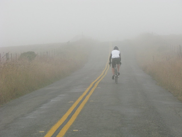
UPDATED What's the weather going to be like?
Will we ride if it's raining?
What's the route?
Is the route marked?
Will we encounter other events along the route?
How much does the ride cost?
How fast do I need to ride?
Can I really ride just 12 mph?
Can I bring bicycle lighting and complete the route after sunset?
What happens if I'm not riding fast enough?
Do I have to ride the entire 200-kilometer route? Can I take a short cut?
What types of SAG service will be available?
Are hotels available near the meeting location?
Got more questions? Email me. Items of general interest will be added to this list.

What is a double metric century?
A double metric century is 200 kilometers, or approximately 125 miles, of bicycling in a single day.

Who should ride the Altamont Pass Double Metric?
This ride is designed for AIDS/LifeCycle riders who desire an extreme challenge to mark the culmination of their training season. The longest day on AIDS/LifeCycle is only about 108 miles, so you do not need to do this ride to be ready for the event. However, many riders have found that taking part in the double metric helps make the longest days of ALC seem a little bit easier.

Is qualification required?
You should have completed at least a 100-mile ride before May 14. Otherwise, the jump in mileage might be too much, and you might not be able to complete the ride, or you might injure yourself just a few weeks before AIDS/LifeCycle 10. You don't need to tell us what century you've done, but please honestly assess your abilities.

Is pre-registration required?
No; but we'd really appreciate it if you did. This will let us give an accurate roster to the SAG drivers so that they can identify or locate you if necessary during the day. To RSVP, use this link to send email.

Must I be registered for AIDS/LifeCycle?
No; this ride is open to everyone who can ride fast enough and who agrees to ride according to our rules. If you're not yet part of ALC, perhaps this ride will persuade you to register for next year's event!

What happens on ride morning?
Our meeting location is next to condominiums (and a police station), so please be quiet and respectful when arriving. You should plan to arrive at the meeting place in downtown Mountain View by 5 a.m. so that you have plenty of time to unload your bicycle and sign in. Although you will park in the same place as we've done throughout the season, sign-in and warmup will take place one block away, on the other side of Shoreline Blvd., as shown here:

After you arrive, ride or walk one block west on Evelyn Street under Shoreline Blvd. into the large parking lot, where you will sign in and receive your frame and helmet numbers. After the safety speech, we will ride out past the parking area, so you can visit your vehicle if necessary before the ride begins. At sign-in, you will receive a frame number for you to affix to your bicycle frame, and a helmet number for you to put on the left side of your helmet. (This is separate from your ALC rider number.) The frame number will be important throughout the day for SAG drivers and other riders to identify cyclists who are part of this ride. Warm-up exercises and the route briefing begin at about 5:30 a.m. All riders must be already signed in, present, and attentive at 5:45 a.m. for a mandatory safety speech.

Can I use the toilet at the nearby police station?
Sorry, no; the police station isn't open for public access that early in the morning. Please take care of your restroom needs before arriving, and make sure your water bottles are full and ready to go.

What's the weather going to be like?
Early forecasts suggest that this year's ride could see the lowest temperatures of any year so far, with temperatures in the 50s and lower 60s through most of the day. We might experience light to moderate headwinds for part of the afternoon. There is a very slight chance of light showers. In short, could be just about anything. Past years of this event have seen temperatures above 100 degrees, but in 2010 we had a pleasant day in the 50s and 60s. The historical temperature data for Livermore on May 14 shows an average high of 77 degrees and a record high of 98.

Will we ride if it's raining?
Probably yes. We will cancel the ride only if there is steady, heavy rain on ride day or if there is a likelihood of thunderstorms or other severe weather.

What's the route?
You will receive a route sheet on the morning of the ride. We expect that the route will be mostly unchanged from last year. This year's preliminary route is here; the route from 2010 is here. Last-minute changes are possible due to road work (especially along Mission Blvd. in Hayward) and other unforeseen events.

Is the route marked?
No; there are no pavement arrows, signs, or other markings. There are approximately 65 turns on the route, so you will need to refer to your route sheet frequently during the ride; consider a map holder or binder clips. On some parts of the route, you will see pavement arrows of various colors and styles; these are for other events to other destinations, and you should not follow them.

Will we encounter other events along the route?
We know of no other organized cycling events that will be following our route on May 14. The rodeo that has taken place on ride day in Dublin during past years is scheduled for a different date this year. Also, there is no street festival in downtown Mountain View on ride day this year.

How much does the ride cost?
It's free! Our six rest stops are all at coffee shops, restaurants, and grocery stores, so you will need to buy or bring your own food and liquid. If you use any of the nonperishable supplies from a SAG vehicle, such as extra tubes, please consider making a small donation to the driver to help cover the replacement cost of these items. The SAG drivers also pay for gas, food, and water and are not reimbursed by ALC, so you are encouraged to help cover their costs if you are able to do so.

How fast do I need to ride?
This ride is designed for riders who can maintain an average speed of at least 12 mph on flat to rolling terrain. We love all cyclists, but the 12 mph pace is necessary to complete the route before sunset.

Can I really ride just 12 mph?
Yes! There will certainly be riders who are faster than 12 mph, but if you ride a steady 12 mph pace and do not take too long at rest stops, you can finish this ride in 14 hours or less. There will always be at least one ride leader at the back of the group, so you are guaranteed to never be the slowest rider. Here's some math: If you take half an hour at five of the six rest stops and give yourself an hour for lunch at one rest stop, and if you assume that you'll spend 15 minutes waiting at traffic signals and stop signs, then you need to average 12.2 mph to finish before sunset. Plan on going a little faster on flat terrain and a little slower uphill.

Can I bring bicycle lighting and complete the route after sunset?
Sorry, no. AIDS/LifeCycle rules require at least one ride leader to be behind the last rider at all times, so you can't finish on your own. This is for your own safety!

What happens if I'm not riding fast enough?
Each of the six rest stops will have an official closing time noted on the route sheet, timed to allow you to complete the ride within the 14 hours of daylight on ride day. This is to help you gauge your progress throughout the day and keep you on track to return to Mountain View before sunset at approximately 8 p.m. If you are in a rest stop at its closing time, you will need to resume riding immediately, or you can choose to end your ride there. In some cases, a SAG vehicle might be able to jump you to the next rest stop and allow you to resume riding, but this service is available only if SAG vehicles are not otherwise occupied with more important tasks.

Do I have to ride the entire 200-kilometer route? Can I take a short cut?
There is no official "short route" for this year's ride. However, there are several places along the route where you can skip ahead from 5 to 37 miles, and several BART and VTA light rail stations are on or near the route. If you decide to shorten your ride or leave the route, you must let a ride leader know, either in person or by leaving voicemail or a text message on a ride leader's cellphone. Phone numbers will be on the route sheet that you receive on ride morning. Also, if you skip far ahead of other riders, you will be out of the coverage area of SAG vehicles, so you will not be able to receive support. The SAG vehicles need to be available on the official route, so if you leave the route, you'll be on your own.

What types of SAG service will be available?
We will have several volunteer SAG drivers stationed along the route and at rest stops. Most will have basic supplies like water, ice, light snacks, and some basic bicycle equipment such as a floor pump and extra tubes. In some cases, the SAG vehicle can transport you to a nearby location if you are unable to continue riding. Please note, however, that the SAG vehicles are not a personal taxi service, and if you decide to stop riding, it is your responsibility to get transportation for you and your bicycle back to Mountain View or some other location. Please respect and thank our volunteer SAG drivers who are helping make your ride a success.

Are hotels available near the meeting location?
If you are coming from far outside Mountain View, you might want to consider getting a hotel for the night before the ride, so that you can arrive on time. Several hotels are available in a variety of price ranges within five minutes of the meeting location; any of the online booking services can steer you in the proper direction. Note, however, that the Pacific Euro Hotel, one block from our meeting location, is largely a residential hotel and might not offer you the experience you need in order to be ready to ride in the morning.

Distance Training #10: Altamont Pass (5/14/2011)


Meet time: 5:00 a.m.
Ride-out time: 6:00 a.m.
Meeting place: Three blocks west of the Mountain View Caltrain and VTA station, in the overflow parking lot at the corner of Evelyn Avenue and Franklin Street. (map)
City: Mountain View
Rain policy: Heavy rain cancels
Category: 3 - moderate-fast pace (12-15 mph)
Terrain: 2 - rolling hills
Miles: 125

Description:
If you are an intermediate or advanced rider who already has completed at least one century ride at a pace of at least 12 mph this season, you are invited to ride in the Fourth Annual Altamont Pass Double Metric, where we ride 200 kilometers (125 miles) in one day.

The terrain on this route is not extremely difficult -- total climbing is only about 2,820 feet -- but potentially strong afternoon headwinds and very hot temperatures have sometimes combined in the past to make this ride more challenging than it looks. There are no stupidly big hills on the entire route!

From our meeting point in downtown Mountain View, we start by crossing the Dumbarton Bridge and passing through Newark and Fremont on our way up Niles Canyon to Sunol. Next, we'll head through Pleasanton and Livermore on our way to the Summit Garage at top of the original Altamont Pass along the historic Lincoln Highway.

Then, we'll retrace our route back to Pleasanton and then head up and over the Dublin Grade into Castro Valley. After that, we'll take city streets through Hayward and follow Mission Blvd. into the Mission San Jose district of Fremont. Finally, we'll pass through Milpitas, San Jose, Santa Clara, and Sunnyvale on our way back to Mountain View.

We ride out at the crack of dawn. You'll have about 14 hours (including stops) to complete this route. Ride leaders will be encouraging riders to make steady progress throughout the day and not linger at rest stops, so that everyone can be back in Mountain View before sunset.

This is an epic ride, but it is very doable, and your ride leaders and volunteer roadies will be on hand to help you succeed. But please, for your own health and safety and the safety of other riders, do not sign up for this ride if you will not have completed at least one other 100-mile ride before May 14.

The meeting point is next to some condominiums, so please keep noise to a minimum when arriving at this very early hour. The police station next door will notice if we become loud. Restrooms will not be available, not even at the police station, so take care of your needs before you arrive.

Leaders: Chris Thomas, Genevieve Breed, Thomas Fortin, Terri Meier, Paul Vargas, David Gaus, Kevin Hunter

RSVPs are strongly encouraged for this ride so that you can be kept informed as the date approaches.

Distance Training #9: Gilroy (4/30/2011)


Meet time: 6:30 a.m.
Ride-out time: 7:00 a.m.
Meeting place: Three blocks west of the Mountain View Caltrain and VTA station, in the overflow parking lot at the corner of Evelyn Avenue and Franklin Street. (map)
City: Mountain View
Rain policy: Heavy rain cancels
Category: 3 - moderate-fast pace (12-15 mph)
Terrain: 2 - rolling hills
Miles: 88/110

Description:
Today, we're traveling all the way down to Gilroy. We head through Saratoga and Los Gatos, then go around south San Jose and up to the Calero and Uvas reservoirs, then in the back way to Gilroy. After that, we travel up the east side of the valley to Morgan Hill, back up Santa Teresa into south San Jose, then back through Los Gatos and Saratoga with a little attention-getting hill right at mile 100 just for fun.

The biggest challenge on this ride is the possibility of strong headwinds on the second half of the ride, making the flat terrain much more challenging. There's a bailout option at about 88 miles by taking the slow VTA light rail back to Mountain View -- not much faster than cycling.

Total climbing on this ride is about 2,900 feet. Our outstanding SAG service will be available.

The meeting point is next to some condominiums, so please keep noise to a minimum when arriving at this very early hour. The police station next door will notice if we become loud. Restrooms will not be available, not even at the police station, so take care of your needs before you arrive.

Leaders: Chris Thomas, Kathy Sherman, Thomas Fortin, Bob Katz, Amir Barzin, Linda Kemmer, Paul Vargas, Randy Files

RSVPs are requested but not required.

Ride report: Distance Training #6 (3/27/2011)

Go, riders!

It's not an understatement to say that, in the five years that I've been leading training rides for AIDS/LifeCycle, today's 81-mile ride to Calaveras (Plus) was one of the most epic adventures that I've been part of. Between the recent storms, today's cold temperatures, and some unexpectedly strong headwinds for much of the day, our intrepid group of 19 riders faced countless challenges, both mental and physical, and many of us ended the day not in the best of spirits.

The day didn't start that way, however. All of us (well, except for one rider who suffered a broken spoke early on) successfully conquered the "hard" direction of Calaveras Road -- and that by itself is an accomplishment worthy of congratulations and respect. There is no climb on ALC as tough as the top of Calaveras Road (at least not anymore -- ask a veteran about Halcyon Road on Day 6 of ALC7 sometime), so even if you walked the last little bit before the summit, you still completed a very significant climb.

And the rewards today were absolutely magnificent; the Calaveras Reservoir was as full as I've ever seen it, and except for the mud on the road, the scenery was almost bucolic. Sure, we had a few flat tires -- not entirely unexpected given all the debris on the road -- but we made it into Sunol in relatively good shape.

However, that's where things started to head south turn sour. (No, that wasn't a very apt metaphor, was it.) Each of us no doubt has their own story to tell about what happened next, but I'll share mine.

In advance of the "last" storm system for now, the wind picked up out of the west, right in our faces as we began to head down Niles Canyon (which, incidentally, was especially scenic due to the flooding). And the wind kept increasing as we traveled through Union City, Fremont, and Newark on our approach to the Dumbarton Bridge. By the time we reached the bridge ... wowza. I was having flashbacks to my windfest in Death Valley one month ago, almost to the day. I was down in my low gears and struggling to maintain 10-11 mph ... and I was getting cold, too, as the wind started to carry a definite chill.

The push through Menlo Park and up to Rest Stop 3 was quite difficult for me, and I spent much more time than usual there, debating whether I should pack it in for the day. I checked my nutrition, which seemed to be going according to plan -- in fact, my mood was generally OK despite the challenging weather -- but then I committed one of the cardinal rest stop sins: I just sat there. I didn't stretch or do any other type of exercise. And because the sun had gone behind the clouds and the temperature had dropped even more, my muscles began to revolt. As I prepared to get on my bike to head back out, the muscles in both legs spasmed at the same time. I did some impromptu massage, and to make a long story short, I was able to finish the entire route ... but much more slowly than usual, and by taking a lot of quick breaks off the bike to repeatedly tense and release my leg muscles to keep them active.

Why do I tell you all of this? Because it's important that you know today's ride was far more difficult than even I planned ... and if you had trouble, you certainly weren't the only one.

How does today's ride compare to days on the ride in June? If you don't count the weather and just consider the technical details of the route, it's about as difficult (and about the same distance) as Day 1, although the climbing is more evenly distributed on Day 1 than it was today. Add in the weather, however, and today felt a lot like Day 6 has felt for me in many past years. Even though I've always trained well, Day 6 has often managed to be a foul day for me: The day starts with a gradual 1,000-foot climb, our route around Santa Barbara is usually "lumpy," and by then the rigors of the week often have taken their toll on me. That said, however, I completed Day 6 of ALC9 in fine form and spirits, so it's just another of those things that is different for everyone, every time.

Although it wasn't really under my control, I feel like I should apologize for the unexpected difficulty of today's ride. Any time more than a third of my riders don't complete a ride, it raises a little yellow caution flag here at Ride Leader Central, because I want you to keep coming back for the rest of the season. No matter how many miles you completed today, you put forth a first-rate effort under challenging conditions. And if your training has suffered during the recent storms, there's still plenty of time to get back on track.

Speaking of that, our next ride is coming up quickly -- this Saturday, in fact! We're going back to the East Bay, and yes, there are again some challenging hills on the route. We're riding to the Cal State East Bay Hayward campus -- you know, that big building you see sitting on top of the hill as you travel through Hayward. But that's only the beginning of the climb; after we pass through the campus, we'll keep climbing all the way to the top of the Hayward hills, at about the same elevation as the top of Calaveras on today's ride. There's one important difference, though: I've thoughtfully placed a rest stop (with a Subway!) about halfway up the hill. You can find out more and RSVP here. And although the ride is listed as 89 miles, you can cut it to about 78 miles by hopping on VTA light rail ($2 cash) for the last part into downtown Mountain View.

A special shout-out goes to today's SAG drivers, who were unusually busy. Taryl was with us all day, and Dennis pulled double duty: He joined us after being a SAG driver for today's Sunnyvale ride as well. I'm sure the riders who Dennis transported are quite happy that Dennis was there for us!

Today's ride was epic, and you should feel proud of whatever you accomplished in these trying conditions. This is also a good time to remind yourself why you ride. Thank you for being part of AIDS/LifeCycle.

Will we ride this Sunday?

Updated Saturday night
Yes!

But be prepared for suboptimal riding conditions in the hills and anyplace else where heavy rain has fallen this week ... which is, come to think of it, just about everywhere.

I checked out the route today, and Calaveras is much more debris-laden than usual, and there are countless places where small to medium mudslides have recently occurred and have been cleared. The saturated ground means that conditions can change rapidly, even tomorrow after the rain stops.

On the plus side, however, Alameda Creek is way above its banks, and the scenes in Niles Canyon are far different from what you usually see there. You'll probably want to take photo breaks ... remember to pull safely and completely off the road when you do so, and only in places where there's enough space for you to be completely off the road while taking your pictures.

Don't be surprised to see mud on the road. And when you do, make every effort to avoid it -- it can be as slippery as ice or gravel and send you to the ground in seconds. Also, watch out for fresh potholes (many filled with water, so you can't judge their severity) and debris along the shoulders. And at the approach to the Dumbarton Bridge, the recent restoration work does indeed appear to have eliminated the threat of serious flooding on the west side. There were still a couple small spots of standing water on the east-side approach, however, but they're easily avoidable.

The last remaining slight chance of showers for Sunday seems to have gone out of the official NWS forecast, at least until Sunday night. So it looks like I'm going to be optimistic and not even put the fender on my bike after all. Temperatures will be seasonally cool -- we likely won't get out of the 50s -- so dress warmly. Afternoon headwinds as we cross the bay could make it feel even cooler.

Bottom line: Bring a healthy attitude and proper clothing tomorrow, and we'll have an interesting adventure, one way or the other.

Distance Training #8: South Bay Century (4/16/2011)


Meet time: 7:30 a.m.
Ride-out time: 8:00 a.m.
Meeting place: Three blocks west of the Mountain View Caltrain and VTA station, in the overflow parking lot at the corner of Evelyn Avenue and Franklin Street. (map)
City: Mountain View
Rain policy: Heavy rain cancels
Category: 3 - moderate-fast pace (12-15 mph)
Terrain: 2 - rolling hills
Miles: 100

Description:
This giant loop around the South Bay has a bit of everything. We start with a bit of Peninsula action in the foothills up to Menlo Park. Then, we cross the Dumbarton Bridge and head out to Mission Blvd., where we climb to the Mission San Jose district of Fremont. From there, we head down the east side of San Jose toward Evergreen Valley. Then, get ready for the climb up Silver Creek Valley Road followed by one of the most thrilling urban descents in the entire Bay Area. We'll close by picking up some of our routes from the past to return through Los Gatos, Saratoga, Cupertino, and Sunnyvale.

Total climbing on this ride is about 3,000 feet. Whether this is your first century ever or just your first century of the year, our group of ride leaders and amazing SAG volunteers will be here to help make your day memorable.

P.S.: Even if you've done this ride before, about 10% of the route is new this year.

Leaders: Chris Thomas, Ally Kemmer, Genevieve Breed, Thomas Fortin, Bob Katz, Terri Meier, Randy Files

RSVPs are requested but not required.

Ride report: Distance Training #6 (3/19/2011)

Go, riders!

If you've been wondering about the difference between "rain" and "heavy rain," we got a few lessons today. Our brave group of 10 riders headed to Mountain View in the middle of a highly unseasonable cold and rainy storm to squeeze in as many miles as possible. While most of us decided that 10 miles was quite enough thank you, a few of us continued and racked up almost 25 miles before we threw in the (very wet) towel.

While today certainly wasn't a distance training ride, we did get valuable training in riding in inclement weather. Good cycling gear can make the difference between a miserable day and a bearable one. Refining the techniques I've learned during this miserable winter, here's what I was wearing today: My heaviest-weight long-sleeve jersey, a sleeveless vest, my medium-weight jacket, a fleece neck warmer, a headband that fully covered my ears, long-legged pants, full legwarmers under the pants (!), wool socks, shoes, and heavyweight shoe covers. Whew! The good news is that I stayed comfortably warm through the whole ride. The bad news was that the shoe covers still didn't keep the inside of my shoes dry. I'm still working on that part.

If rain were to happen in June, how bad would it have to be for us to stop riding? It's impossible to say exactly how bad, but today's rain was not as intense as the storm that forced the cancellation of Day 6 a couple of years ago. (As I write this a couple of hours later, however, the rain in Mountain View is about as heavy as it was on that fateful Day 6.) Historically, rain during AIDS/LifeCycle is very rare (just two or three days out of 9x7 = 63 days on the event so far), but with seemingly more unusual weather every year in California, you should be prepared just in case. And that's why rides such as today's are useful, even though we didn't rack up the big miles.

No matter how many miles you rode today, you learned that yes, you can do it. And you probably also learned a bit about what did and did not work for you ... and you can apply those lessons to your next ride in inclement weather.

On the safety front, I was especially pleased today to hear lots of very out-loud voices calling out turns and other events during the ride. Safety is even more vital in bad conditions, and we all need to give each other plenty of room because our bikes might not always do what we want them to -- such as braking quickly enough.

What's next? I've rescheduled our 81-mile ride for next Sunday, March 27. I was of mixed feelings when I made this decision because I know that many of you already have plans for other rides that day. But because of the ALC Expo in San Francisco next Saturday, we can't ride on the 26th, which would be my normal make-up date. And I'm also concerned because the first forecasts for next weekend show yet another storm coming through the area. If we get rained out again next weekend, I'll be making some changes to our schedule (including riding more often than every other week) so we can stay on target for doing 200 kilometers on May 14.

Details and RSVP for next Sunday's ride are here.

With all this rain, don't panic yet over not getting as much training as you'd like. There's still more than two months before the ride, and there will be plenty of opportunities for you to build up to the big miles on consecutive days. (We hope!) Stay dry and warm, and thank you for being part of AIDS/LifeCycle.

Ride report: Distance Training #5 (3/5/2011)

Go, riders!

Finally, some decent weather, if only for a few more hours. But the recent storms have taken their toll on training for many of us, and in today's group of 43 intrepid riders, the strains showed in a few places. Nonetheless, everyone finished well ahead of the closing time, and you definitely are to be commended for that ... especially if today was your longest ride ever and your previous longest ride was only 50 miles, as was the case for several of you. This gets you right back on track to ride the Altamont Pass Double Metric in just 10 weeks, and to be ready for the longest day of ALC10 (Day 2 at about 106 miles).

In my case, I completed 72 miles last weekend, but under the harsh conditions of a Death Valley windstorm. I'm not saying this to brag; instead, it had a profound influence on how I rode today, and not for the better.

I was so happy to be riding in favorable weather for a change that I kind of let myself go. I started riding harder and faster than I normally go on a training ride -- which, for me, meant an average pace of just under 15 mph by the time we got to lunch in south San Jose. That was an unwise decision on my part, because I certainly felt it for the second half of the ride, where my pace decreased considerably and my pain level increased.

The real giveaway was when I pulled into Rest Stop 3 in Saratoga and dismounted. I let out some sort of audible noise, and another of the ride leaders asked me if I was OK. I said sure, I was just fine, but he said that the look on my face told a different story. I wasn't bonking or anything; I had simply cycled too hard for my current training level, and I was paying the price in various pain points throughout my body. My lesson learned, I took it much easier the rest of the way back to Mountain View (well, except on a couple of the gentle descents).

I'm reminded of some sage advice from 18-time (!) AIDS rider Doreen Gonzales: "Find your happy gear." Those four little words can mean the difference between success and failure on your ride. Your happy gear is the one where you can spin without undue force. Your actual speed is irrelevant; they key is to find a cadence that you can sustain for a long period of time. On our shorter training rides, you could get away with doing the whole day at "race pace," but now that we're into the really serious distance, it's time to plan your days for the long haul ... and with an eye toward having to do the same thing over again the next day and the day after that.

We dealt with some roads today that aren't the best cycling routes, even if they're popular. In particular, McKean Road in south San Jose was obviously filled with cyclists in both directions today, but the shoulder was intermittent at best. Moreover, the traffic, while not heavy, was passing nearby at moderate speed of 45-50 mph. This was a very accurate simulation of what you'll find on much of Days 2 and 3 on the ride when we travel the rural roads of Santa Cruz and Monterey counties for hours at a time. While most car drivers are courteous, there always will be a few who are not -- particularly in June when they'll be navigating around hundreds or thousands of cyclists. Be aware of your surroundings, and if you see potential trouble with a car or truck, do your best to avoid it. Even if you're "right," whenever it's car vs. bicycle, the bicycle always loses.

Although today's hills generally weren't that bad, Mount Eden was a new experience for many of you. The advice I gave this morning is appropriate whenever dealing with an unfamiliar climb or descent: Take such hills much easier than a road you know well. In June, you'll encounter countless climbs and descents, and if this is your first year in ALC, chances are that most of them will be new to you. When you consider the pavement quality, the curves, the steepness, the lane width, and the unknown distance, that's a lot of factors that you need to be aware of. Even if you see someone else taking a descent much faster than you, don't feel the need to keep up with anyone else; go at the speed that's comfortable for you, and don't ride beyond your ability. In my five ALC rides, I've seen some truly nasty crashes on descents, and being near one can really put a damper on your day even if you're not involved. Remember that there's no reward for getting down the hill first; the only reward is for getting down the hill safe.

What's next? In two weeks, we'll ride "Calaveras Plus." We'll travel to the East Bay for our scenic but challenging climb up the "hard" side of Calaveras Road. This 80-mile ride will take you into a remote part of Alameda County (so remote that there's no cellphone service) with amazing panoramas as we travel high above the historic Calaveras Reservoir, which once was the largest earth-fill dam in the world. After that tough climb, we'll have a long stretch of downhill or flat riding as we pass through Sunol on our way to Fremont and across the Dumbarton Bridge. After that is where the "Plus" comes in. Instead of heading directly back to Mountain View, we'll go back uphill into Woodside and ride around the back part of the Stanford Loop before finishing our day. You'll definitely want to save some energy in reserve for the last part of this ride! Meet time is yet another half-hour earlier, at 8 a.m.; find out more and RSVP here.

And if you're in San Jose this Tuesday Wednesday (oops!) night, you might be interested in attending a meeting of the VTA Santa Clara County Bicycle Pedestrian Advisory Committee. Their subject this month is very relevant after our ride today: They want to "identify the rural and mountain roads popular with bicyclists" and "develop a list of potential improvements for these roads." You might have some strong opinions about this! This workshop will take place at Wednesday in the VTA Auditorium at 3331 North First Street in San Jose. More info is here.

Don't forget the ALC Cyclist Expo three weeks from today in San Francisco. The details are here, and you'll be able to ride with a larger group of ALCers plus attend workshops about various aspects of the ride. Also, the ALC store will be opening, selling previous-year ALC gear at steep discounts. Build your jersey collection for pennies on the dollar!

Thanks for riding, and thank you for being part of AIDS/LifeCycle.

Just how much climbing IS that?

This is a revised version of a posting I originally made in 2009. Yes, Ride With Chris is doing reruns now. Deal with it.

Now that we're getting into the thick of training season, we're starting to see some training rides with a lot of climbing in them. But how much is "a lot"? The answer can vary widely depending on what mapping software you use.

If you're like me, you've looked at some rides out of San Francisco and thought, "Good grief, all that climbing! Why do they do so much?" For example, one late-season ride in 2009 was advertised as 7,644 feet of climbing, and a recent ride this year was advertised at about 6,200 feet.

But here's the secret: There are many different pieces of mapping software, and some of them give wildly different numbers whenever substantial climbing comes into play. I mapped these same two rides using Bikely (which is what I use for all of the rides that I lead), and the difference was startling: The first one was 5,002 feet, and the second one was 3,600 feet.

This doesn't diminish the difficulty of the San Francisco rides in any way whatsoever -- some of those hills are very challenging. But what it means is that the training you're getting on the Peninsula and in the South Bay, both on the Distance Training rides and on the Saturday and Sunday Cat-2 rides, is indeed quite comparable to what's on offer in San Francisco.

Photo credit: Marshall Wall fog, by Andrew Hecht

Distance Training #7: Hayward Hills (4/2/2011)


Date: Saturday, April 2
Meet time: 8:00 a.m.
Ride-out time: 8:30 a.m.
Meeting place: Three blocks west of the Mountain View Caltrain and VTA station, in the overflow parking lot at the corner of Evelyn Avenue and Franklin Street. (map)
City: Mountain View
Rain policy: Heavy rain cancels
Category: 3 - moderate-fast pace (12-15 mph)
Terrain: 3 - rolling hills with some steep climbs
Miles: 89

Description:
A new training route for 2011!

The first 33 miles of this ride are easy and flat as we head through Palo Alto, across the Dumbarton Bridge, and into Hayward. But then, get ready ... we're going to school!

Yes, really: We're going to climb through the Cal State East Bay Hayward campus on the route of last autumn's Seismic Challenge. If you were there or know somebody who was, then you already know that this hill (on the appropriately-named "Harder Road") is quite steep, and that's putting it mildly. But the views of the bay are nothing short of amazing. Once we reach campus, we're not done; we'll keep on climbing, all the way to the top of the hills at about 1,200 feet elevation. And because we climb, we must also descend ... down the thrilling Five Canyons Parkway into Castro Valley.

But wait, there's more. Next, we'll climb to the top of the Dublin Grade, but in the kinder, gentler direction. From there, it's a comparatively easy ride through Dublin and Pleasanton into Sunol and down Niles Canyon. There, our final climb awaits: the gradual ascent to the historic Mission San Jose district of Fremont, where we'll have the last of four rest stops before heading through Milpitas, San Jose, Santa Clara, and Sunnyvale on our way back to Mountain View.

Our outstanding volunteer ride leaders and SAG drivers will be on hand to help you succeed. Total climbing for the day is about 2,900 feet, but almost all of that is packed into the middle 35 miles of the ride.

Leaders: Chris Thomas, Kathy Sherman, Thomas Fortin, Bob Katz, Amir Barzin, Paul Vargas, Linda Kemmer, David Gaus, Randy Files

RSVPs are requested but not required.