Go, riders!
You pretty much can't ask for finer cycling weather than we had today -- even though you might not have been as hopeful when you awoke to near-freezing temperatures this morning. But our group of 29 intrepid cyclists enjoyed the conditions so much that some of us might have momentarily forgotten that we were climbing some very challenging hills. (And thanks to Tom, now an official Friend of ALC, for stepping up at the last moment to be our SAG driver.)
The good news is that the event in June has no hills as challenging as Parrott Drive. (But a few years ago, there was one ride that had a hill almost as tough on Day 4 when we got rerouted.) But as you move through the seven-day event, it's common for smaller hills to start feeling tougher than they really are -- so even though there's no Parrott on the event, it might almost feel like there is.
We had a small taste of that toward the end of today's ride when we climbed La Cresta Drive. Yes, it's a difficult hill, but it's not nearly as challenging as Parrott. When I did La Cresta today and checked my results later, I saw that my pace on La Cresta today was quite a bit below my other recent visits there, and it's a safe assumption that I was feeling at least a bit tired by then. Remember to listen to your body and search for your "happy gear"; the hill is still there, even if you take a few extra seconds (or minutes!) to climb and/or descend it.
I learned about Parrott Drive back in 2006 on Le Tour de Menlo. I, of course, had about seven fewer years of cycling experience then, and I distinctly remember lifting my front wheel into the air at one point on the steepest part of Parrott. During the few minutes that I stood there today, I saw the same thing happen to a couple of other riders, too!
I didn't have the confidence to return until several years later, and now I lean way forward and put as much of my weight as I can toward the front of the bike. (Of course, I saw some other riders today simply stand up and power their way through the steepest part. If you can do that, more power to you ... literally!)
And as with many unfamiliar hills, I can almost guarantee that Parrott would seem easier the second time you do it. One thing you'd know about is how well (or poorly) the curves and turns are engineered. One turn in particular was very, very nasty, and riders who didn't move to the left side of the lane might have gotten trapped and had to dismount to get around the corner. That's OK, too! But noticing the different grades on turns will be very important on our next ride when we go up Redwood Gulch Road, which has one curve where the inside, near the center line, is "only" 13% but the outside is a quad-busting, almost-impossible 21%. I strongly recommend using the inside if there's no other traffic around!
The central and lower Peninsula area has countless short but steep hills that are excellent for building strength. If you live in the area, I'd recommend scoping some of them out. You can use tools such as Strava to search for segments and see in advance the distance and terrain. Last year while wearing my Different Spokes San Francisco ride-leader hat, I led a 25-mile "Los Altos Hells" ride -- seven short hills all with grades of at least 10%, and all within just a few miles of our Mountain View meeting location.
You don't have to train on very steep hills to be ready for ALC, but for intermediate and advanced cyclists (like you!), this type of training can make June much more pleasant.
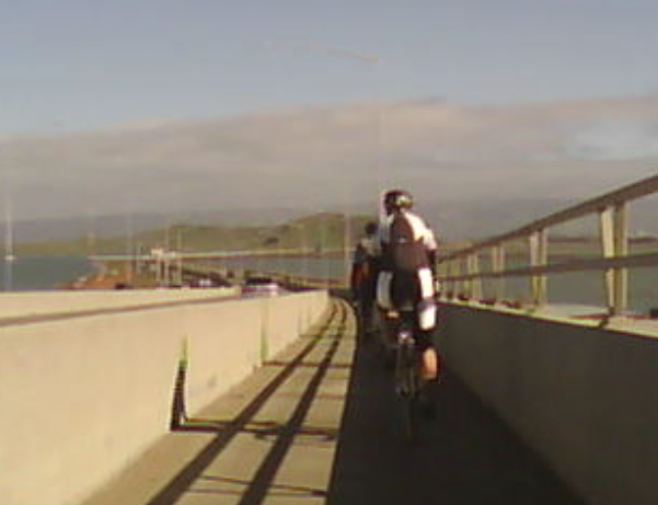
Other than the climbing, today's other big feature -- for better or worse -- was a bit more urban riding than usual, complete with annoying stop signs at annoying places. Some of that was because I'm still avoiding taking us on westbound Junipero Serra until the PG&E gas project is done, but some of it was because it's an unavoidable fact of life in June as well. (Don't worry; I'm specifically not talking about the stop signs on Parrott Drive here.) Every time I come across a series of closely-spaced stop signs, I think of Day 4 approaching Pismo Beach. It's a similar situation, and we've stirred the anger of local authorities in some past years by not observing all of the stop signs. It can be frustrating, especially when you can practically smell the cinnamon buns that are just a couple of miles away, but it's also part of the ride.
My apologies for a small error on today's route sheet. The exit from Foothill Expressway is actually "Fremont / Miramonte / Loyola," not "Foothill / Miramonte / Loyola." Most of us locals know that exit instinctively and do the right thing out of habit, but it tripped up one of our guests from San Francisco today. The funny thing is that I make sure I put those three streets on the route sheet in the same order as they're listed on the exit sign, and I remember the order by thinking of the slightly-impolite acronym FML. I got the F part right, but I stupidly typed the wrong street. Sorry about that!
Several of our regulars missed today's ride due to either illness or today's Tour de Palm Springs. If you're reading this but didn't ride with us today, be sure to do a ride of about 60 miles sometime in the next week or so. That's because our distance starts to increase quickly from here, and falling behind could make it difficult to jump back in to our sequence of rides.
Indeed, our next ride takes a jump all the way up to 71 miles. We're going to climb another hill that I've never had on one of my training rides until now. (However, I'm told that it used to be part of the Sunnyvale Cat-2 rides several years ago.) Redwood Gulch Road is a mercifully short but unmercifully steep connection from Stevens Canyon to Highway 9. Like Parrott, it does a stairstep of steep, flat, STEEP, and flat. The flat parts are a little flatter, but the steep parts are a bit steeper. Again, however, a positive attitude will go a long way to getting you up the 1.3-mile hill. (And you can always walk some or all of it with no shame whatsoever.)
The reward for climbing Redwood Gulch is a glorious 4-mile descent on Highway 9 into Saratoga. The construction zone on Highway 9 is gone, so there's no longer a traffic signal partway down the hill! And the total climbing is about the same as today's ride -- and nearly half of the climbing occurs just getting to the top of Redwood Gulch, in the first 12.5 miles of the day! That means that the rest of the day is relatively tame. If you made it up Parrott today (and even if you cross-trained part of it), then you can do the Redwood Gulch ride. Find out more and RSVP here.
When you look at the listing for the Redwood Gulch ride, you'll notice that I've increased the official pace to 12-15 mph. That's where we'll be for the rest of the season, but this shouldn't worry you at all. Everyone on today's ride is more than sufficiently qualified to ride my Cat-3 rides. (Really!) The main reason for the change is that, as our rides get longer, we start flirting more closely with sunset, and a total beginner might not be able to make it back to Mountain View before darkness. There won't be anyone pulling you off the route if you're at 11.8 mph. And remember, that average is over an entire ride, not just the steep climbs. My best pace ever up Redwood Gulch is a blazing 5.3 mph (which earns me 1,035th place in Strava), so don't let your time on that climb discourage you one bit.
Finally, a couple of words about some cycling behavior I saw today that ... pleased me greatly. I was part of a long line of cyclists making our way through the traffic signals of Palo Alto. Our footprint would naturally expand as we pulled away from signals, and then it would bunch up again at the next red light. Then, after the light turned green, those of us at the back would slow down and simply latch on to the back of the group ... instead of continuing on at full speed and blowing past the riders who had just been stopped. This shows consideration not only for other cyclists, but for motorists as well, who shouldn't have to deal with us swerving out into the traffic lane just to get around five or six cyclists who had the misfortune to get a red light.
In June, I often see the opposite behavior by ALCers, especially around Santa Cruz on Day 2 and through Malibu on Day 7, and it always annoys me. It's not a race, and you'll rarely go wrong by considering how your actions will affect -- and will be perceived by -- those around you. It's often the faster cyclists who exhibit this behavior on the event, so we can help set a good example by being courteous and remembering that the ride isn't about "me" ... it's about all of us.
Thanks for riding today, and thank you for being part of AIDS/LifeCycle.
Upcoming rides I'm leading:
Nothing on the schedule.
ALC12 Distance Training #5: Coyote Valley Plus (2/23/2013)
Date: Saturday, February 23Meet time: 9:30 a.m.
Ride-out time: 10:00 a.m.
Meeting place: Parking lot at Villa and Franklin streets, Mountain View (across from the Tied House) (map)
City: Mountain View
Rain policy: Heavy rain cancels
Category: 3 - moderate-fast pace (12-15 mph)
Terrain: 3 - rolling hills with one very steep climb
Miles: 71
Description:
Coyote Valley, directly south of San Jose, is a popular cycling destination, and there are many ways to get there from Mountain View. Today, we'll be using one of the most challenging. (That's the "plus"!)
Redwood Gulch Road provides a short but steep connection between Stevens Canyon and Highway 9. This climb is officially 1.4 miles at 9.4%, but it has some easier sections and some very steep sections, even a little bit steeper than the parts of Parrott Drive that we did on our last ride. Cross-training is perfectly OK! The reward is a glorious 4-mile descent on Highway 9 into Saratoga ... and no other steep climbs the rest of the day. (And, come June, you will be sooooooo ready for Quadbuster, which is 1.4 miles at 7.6%.)
Half of the day's total climbing comes in the first 12.5 miles, so after Redwood Gulch, the rest of the route is relatively sedate. We'll take a break at Saratoga Village and then pass through Los Gatos on our way to Almaden Expressway in south San Jose. At the end of the expressway, we'll ride alongside Calero Reservoir for a couple of miles before descending on Bailey Road. Then, we stop for lunch at a large shopping center with many options before making our way up Santa Teresa Blvd. (where headwinds are possible) and back through Los Gatos and Saratoga. We finish with an easy ride from Saratoga (no climbing) back to Mountain View.
Total climbing on this ride is about 3,000 feet. Beginning today, the Distance Training rides move up to a Cat-3 (12-15 mph) pace. This is so that everyone can be back in Mountain View before sunset. But it's perfectly OK if you're at the low end of this range; you DO NOT need to be a 15 mph cyclist to do this ride!
You can end this ride at Mile 42 by taking VTA light rail back to downtown Mountain View. The trip costs $2 and takes at least 90 minutes ... not much faster than riding it, but the option is there if you need it.
This ride is Caltrain- and VTA-friendly. The first southbound train of the day leaves SF at 8:15 and arrives in Mountain View at 9:29. We're about four blocks from the station.
If it rains before or during our scheduled time, but not heavy enough to cancel the entire ride, we will reroute for safety to avoid Redwood Gulch.
Here's a short video preview of Redwood Gulch, with the approximate grade shown at several locations throughout. This should help you know what to expect and how to budget your energy during the climb.
Click here to RSVP
RSVPs are requested but not required.
Ride report: ALC12 Distance Training #3 (1/26/2013)
Go, riders!
I promised you a rain-free ride, and that's exactly what I delivered. I did not, however, promise a rain-free pre-ride.
When the skies unexpectedly opened up half an hour before this morning's ride, I was as surprised as everyone else, and I started to worry more than a little about what we were getting ourselves into. (At least the waivers have dried out enough that I can send them to ALC World HQ!)
But as if by magic, the rain ended just before our 10 a.m. ride-out time, and our group of 36 intrepid cyclists had a completely rain-free 50 miles.
This was about as easy a 50-mile ride as I ever offer, even with the afternoon headwinds. (And special thanks to our super SAG driver Shelley!) As a result, many of us rode the route faster than our normal pace, introducing a certain amount of difficulty to even this simple ride. During training season, that's not entirely a bad thing; on the event in June, of course, you want to take advantage of the easier parts of the route to save your energy for the more difficult parts.
And wind is one of those factors that can increase the difficulty. In June, our route is usually windy, but the winds are usually out of the north or northwest, giving us a glorious tailwind for much of the way to Los Angeles. (On Day 2 in particular, you can rack up some highly impressive average speeds without knocking yourself silly.) But the winds can turn ... and in this era of ever-wackier weather, the past couple of years have even had some "backwards" winds out of the south or southeast that have made some parts of the route more difficult than in previous years.
There generally aren't any deep, dark secrets to riding in headwinds and crosswinds. Just make yourself as aerodynamic as possible, but keep control of your bicycle, especially in strong crosswinds. (And no matter the year, we are virtually guaranteed a short segment of very strong crosswinds just before the water stop on Day 2.) Because our training rides always have to return to our starting point, we'll likely encounter some more wind issues before the end of our season, so it's best to make one's peace with the wind early in the season.
Although a ride as flat as today's certainly was technically easier than most, one thing I noticed is that flat routes don't provide as many opportunities to relax and either pedal lightly or coast through downhills and gentle descents. This can, for some riders, make a flat route actually seem at least as difficult as a route with rolling hills. (And coupled with an increased pace on the flat route, this becomes even more likely.) In June, my own preference is to take whatever easy bits of the route come my way and fully exploit them to my advantage; even when riding "every friendly inch," there's no requirement to pedal EFI as well.
Another aspect of today's ride was the largely urban route. We had a lot of traffic signals and stop signs, and that was by design, too. Although much of our route in June is rural and on roads not necessarily of the best quality (more about that in a moment), we also spend a lot of time in cities and towns, sometimes amid moderate to heavy traffic.
For those of us who normally get out into the wide open spaces for our rides, the constant stop-starts and general hassles of city riding can be an annoyance that can lead to a case of the grumpies. But they're also a fact of life on the event -- and they introduce a whole host of safety issues that we all need to follow, not just for our own sake, but for everyone around us.
Fortunately, most of our remaining rides don't have as many turns and potentially confusing directions as did today's. But please, study the route in advance, especially if you're not familiar with the area. I saw a whole group of riders go astray today because one person missed a turn, and the others followed along. Although the event route in June is usually very well marked, that's not the case on training rides (mine or anyone else's). And even in June, there have been a few cases of riders missing a turn and getting significantly off-route before realizing their mistake. If a route sheet is confusing, or if you think you're lost, just stop and call a ride leader or SAG driver, or simply wait for someone else to come along. My rides are usually challenging enough without extra miles and hills!
As promised, a couple of words about road quality: Yes, the frontage road after the Dumbarton Bridge is somewhat crappy. (It's scheduled to be resurfaced after the seismic retrofit on the bridge is completed later this year, but we'll be riding it again at least once before then.) But it's also a good simulation of what we experience in much of rural Santa Cruz and Monterey counties in June.
Outside the Santa Cruz and Salinas metro areas, the rural roads on Days 2 and 3 are often not in the best condition, and the chip-seal jobs have been deteriorating in recent years. Again, this can put you in a foul mood if you're not prepared for it. Also, suboptimal roads demand that you pay particular attention to the road in front of you so that you can avoid potentially harmful ruts, holes, and bumps. This means leaving enough distance between riders so that you can see what's in front of you, calling out road hazards for others, and riding single-file so that you have enough room to maneuver when necessary.
But all in all, today's ride went extremely well, and everyone was back in Mountain View ahead of schedule. Our next ride is vastly different.
In two weeks, on February 9, we'll head up the Peninsula to San Mateo for a street I've never put on a training ride until now: Parrott Drive in San Mateo. It's got a somewhat challenging climb, but it is a very doable climb. And even in a worst-case scenario, it's only 0.8 mile, and you could walk it in 20 minutes or less. So any cycling time less than 20 minutes will be a win! (And for those who have done my rides in previous seasons, Parrott is easier than Westridge, Joaquin, or Harder, so don't stress out.) My ride description talks more about Parrott in detail, and there's a video of my recent ride up Parrott, so you can see exactly what it's all about. You can do it!
The rest of our next ride isn't flat, that's for sure ... there are a couple of other attention-getting climbs, so it's a good day to work on pacing yourself. I've left the official pace at Cat-2 to try to relieve some of the time pressure, so don't worry. Find out more and RSVP here.
Next Saturday, however, don't forget the ALC kickoff party and expo in San Francisco, starting at noon in the County Fair building at Golden Gate Park. In a change from previous years, there's no official ride associated with the expo, but there are a few rides out of Sausalito and Orinda early in the morning, so you can still ride and be in San Francisco by the afternoon. Parking can sometimes be challenging in the park during the weekend, especially later in the day, so you might want to consider some creative transportation plans such as Muni or even parking elsewhere and riding to the event. An RSVP is required for this event, so sign up here.
Finally, a super-geeky tech note inspired by today's ride, and you can safely skip this whole part if numbers aren't your thing. Our route sheet said that today's ride had only 530 feet of climbing. (Strava reported 506 feet for me today.) But many riders' stats that I'm seeing are showing climbing totals of up to 1,000 feet or more. That's because many altimeters are based on detecting changes in air pressure, and (as I'm sure you noticed) a cold front blew through the area while we were riding today, reducing air pressure and fooling many devices into thinking we'd actually ascended into more rarefied air. The chart shows the barometric pressure today in Palo Alto -- notice that the highest pressure occurred right at our ride-out time.
Many of the common cycling apps can perform elevation correction, either by default or optionally. With elevation correction enabled, the apps ignore the altitudes reported by your devices and instead use massive topographic databases. This usually -- but not always -- yields more accurate and consistent information. That's one of the main reasons why ALC doesn't post official climbing stats for the route: Every app has its own way of doing things, and they most definitely do not agree with one another. For your own training, the best advice is to stick with the calculations from one app and use those as the basis of your comparisons.
When I report climbing stats, I usually use Strava, although I sometimes use Ride With GPS -- but correcting for the usual 10% to 15% inflation that RWGPS reports when compared to Strava. So when you see a training ride on the calendar that claims "9,000 feet of climbing," you might want to ask about the source of that number. I can safely promise that I'll never, ever schedule an ALC training ride with 9,000 feet of climbing according to Strava! This doesn't make the other rides evil; it just means that they're consistently using a different data source ... and, again, that's why there's no one official source of climbing data.
So much for the geekery! Thanks again for riding today, I hope you'll join us again in two weeks, and thanks for being part of AIDS/LifeCycle.
ALC12 Distance Training #4: Parrott Drive (2/9/2013)
Date: Saturday, February 9Meet time: 9:30 a.m.
Ride-out time: 10:00 a.m.
Meeting place: Parking lot at Villa and Franklin streets, Mountain View (across from the Tied House) (map)
City: Mountain View
Rain policy: Heavy rain cancels
Category: 2 - moderate pace (10-12 mph)
Terrain: 3 - rolling hills with one very steep climb
Miles: 58
Description:
Parrott Drive in San Mateo is one of those routes that doesn't get much love. After this ride, you'll probably feel strongly one way or the other about that!
We begin with a gentle route through downtown Palo Alto and up Sand Hill to Alameda de las Pulgas into Belmont. After that, it's up and over the short but steep section of Alameda and through San Mateo. Then comes Parrott. Officially, the main climb is only 0.8 mile at a 7.9% average grade. But that's deceiving. It's actually three distinct short climbs -- about 10% for a quarter of a mile, then about 7% for a quarter of a mile, a short downhill, and finally a nasty 11%-plus grade for the final quarter-mile to the top. In fact, you might even be able to walk part of the hill faster than you can ride it, and that's perfectly OK. There are even pesky stop signs where you can (and must!) pause to catch your breath.
Here's a short video that shows you what to expect on Parrott Drive:
After Parrott, we'll head down to Cañada Road for an easy run in the hills, then we'll do a partial Portola Valley loop, ride around Stanford to Old Page Mill Road, and finish with La Cresta Drive, one of the lesser-known but more stimulating climbs in Los Altos Hills.
Total climbing on this ride is about 3,400 feet. Because of the steep climbing involved, we've left this ride as a Cat-2 pace. Most riders can expect that their pace on this ride will be a little slower than usual.
This ride is Caltrain- and VTA-friendly. The first southbound train of the day leaves SF at 8:15 and arrives in Mountain View at 9:29. We're about four blocks from the station.
Click here to RSVP
RSVPs are requested but not required.
Ride report: ALC12 Distance Training #2 (1/12/2013)
Go, riders!
Even though temperatures mostly stayed above freezing last night, it was certainly plenty cold when our group of 35 intrepid cyclists met this morning in Mountain View. But under a bright sun, today's 45-mile ride was surprisingly pleasant, if not just a bit warm-ish in places. And while we still did plenty of climbing, most of it was without the super-nastiness of last week. Special thanks also go to today's super SAG driver Janet, and our super bonus last-minute SAG driver Dan.
Riding in the cold is, I think, an acquired taste, one that seems less painful after you've become acclimated to it. In my case, I did a lot of riding over the holidays where my day began with temperatures in the 30s or lower 40s, so today didn't really feel all that bad to me. I know that at least a few of you felt otherwise, but I also suspect that if you ride tomorrow morning when it's expected to be just as cold, it might not seem quite as bad the second time around. And keep in mind that, while the event in June almost never sees morning temperatures in the 30s, ride-out temps in the 40s are somewhat common. And while the past few rides have been unusually cool, temperatures in June often exceed 90 degrees, so packing and dressing for all types of weather is very important.
And once we started climbing those hills, we got warm in a hurry. Shannon and Kennedy are both fairly technical climbs and descents, and today's riders wisely took them at whatever speeds felt right. Particularly on a descent that's new to you, it's important to ride within your abilities so that you can respond to quickly changing conditions -- gravel, potholes, mud, wet pavement, and so on. There is absolutely no shame in descending carefully, and there's no prize for getting to the bottom of the hill 15 seconds before everyone else.
In June, many of our major descents are under open-road conditions where most of us will naturally go faster. But even then, take the hills at your own pace (and keep to the right so others can safely pass you).
In the middle of all that climbing, how about that right turn from Shannon onto Kennedy? Steep but mercifully short-lived. Event veterans might recall that there's a very similar turn near the end of Day 4 in recent years, when we make a hard right turn from Los Berros Road onto El Campo Road, where you can't see a steep climb until you're already on it.
But also with unfamiliar territory comes the possibility of missing a turn. That happened today when one rider missed the turn onto Kennedy, continued downhill, turned around and climbed back up, but then missed the turn again and, as a result, climbed Shannon again in the other (much harder) direction! It was quite the hill workout, but I remind you that if you get lost, please don't feel obligated to ride bonus miles. Call a ride leader or SAG driver for directions, and if a SAG driver is available, we usually can find you and get you back on the route.
When we got to Rest Stop 2, notice that I put Togo's at the front of the list ahead of Starbucks this time. That's because our rides are now long enough that it's important to properly eat. Everyone's numbers are different, but Strava tells me that I burned 1,733 calories on today's ride. (Some other tools give higher numbers -- for me, as high as 2,524 calories for this ride.) Most of us can't and shouldn't try to replenish all of those calories while still riding, but even those of us who are trying to lose weight have to take back most of those calories, or else we won't have the necessary energy to keep riding today or on the next day.
One thing that I saw today (and I've seen on other rides, too) can spark an interesting discussion. When making a left turn where there's a left turn lane, do you wait behind other vehicles in the lane, or do you split the lane and pull up alongside the first vehicle waiting to turn? As you've no doubt observed, opinions differ! My own answer is that, when I'm riding by myself, I "usually" wait in line with the other vehicles. My exception is mainly when I know that there's a bike lane on the street into which I'm turning, so that I know I won't be holding up other vehicles. From 2011, here's a lengthy discussion in which several points of view are represented.
When riding in a group, though, the situation can be different. If a large group of cyclists makes it way through stopped traffic to the head of an intersection, it can be perceived as an intimidating "pack" that could spark anger or resentment. And remember that in June, we have to do everything we can to avoid jeopardizing our 50-plus permits that we need in order to ride to Los Angeles. Even though it might be legal to split the lane, it might also be more sensible to wait our turn, even if it takes us an extra cycle to get through the signal.
As far as I know, ALC has no official rule on this, so the choice is yours. But especially when I'm wearing the ALC colors and representing SFAF and LAGLC, I try to err on the side of avoiding confrontation, no matter who's "right."
What's next? Remember that our next ride is in two weeks, on Saturday, January 26. And for a pleasant change, it's a comparatively easy ride: 50 miles, but very few hills. We'll cross the Dumbarton Bridge and pass through Newark and Fremont on our way to Ohlone College and the historic Mission San Jose. Then we'll ride some of the Coyote Creek Trail and take a short detour into otherworldly Alviso on our way back to Mountain View. Find out more and RSVP here.
In the meantime, I encourage you to use next Saturday to ride with one of the other groups in the area. Get out there, and see some more of the great cycling that's available in the Bay Area, even when it's chilly.
Thank you for riding today, and thank you for being part of AIDS/LifeCycle.
ALC12 Distance Training #3: South Bay loop (1/26/2013)
Date: Saturday, January 26Meet time: 9:30 a.m.
Ride-out time: 10:00 a.m.
Meeting place: Parking lot at Villa and Franklin streets, Mountain View (across from the Tied House) (map)
City: Mountain View
Rain policy: Heavy rain cancels
Category: 2 - moderate pace (10-12 mph)
Terrain: 1 - mostly flat
Miles: 50
Description:
Today we take a break from most of our climbing for an expanded version of the traditional South Bay loop across the Dumbarton Bridge. When we reach the East Bay, we'll continue through Newark and Fremont to Mission Blvd., where we'll have a rest stop in the Mission San Jose district. After that, we'll have our few hills of the day on the way into Milpitas, and then we'll take a short detour into Alviso on our way back through Sunnyvale and Mountain View.
Total climbing on this ride is only about 700 feet. If there is heavy rain the day before the ride, there might be a partial rerouting due to possible flooding.
This ride is Caltrain- and VTA-friendly. The first southbound train of the day leaves SF at 8:15 and arrives in Mountain View at 9:29. We're about four blocks from the station.
Click here to RSVP
RSVPs are requested but not required.
Ride report: ALC12 Distance Training #1 (1/5/2013)
Go riders!
Thank you for being part of our group of 35 intrepid cyclists who kicked off the ALC12 training season with today's "attention-getting" climb to Cañada College. Regardless of whether you found it to be just another "spin in the park" or a quad-busting, profanity-laced wake-up call, we got a good preview of what we'll be doing over the next 10 rides on our way to the Altamont Pass Double Metric in mid-May. And today's ride was very similar in distance and difficulty to Day 5, the shortest day (but not the easiest) of the event in June.
First, thanks to everyone for being mostly on time, which allowed us to ride out promptly at 10:00 ... which also allowed us to beat the rain. Please don't forget to sign the waiver when you arrive, and don't forget to sign the sign-out sheet when you return at the end of your ride.
We operate on a tight schedule because, as our rides get longer, we'll need to maximize the amount of daylight available for riding ... and because it's good practice for the event in June. In fact, being ready to ride out at opening time every day during the event is often one of the best ways to have a better ride -- you don't feel as much time pressure, and the roads usually aren't as crowded. (On Day 2 in particular, it's vital to get on the road as early as possible to beat the Monday morning commuter traffic in the Santa Cruz area.)
Another way to make your training rides more enjoyable is to avoid riding "bonus miles," the extra distance that you cover when you miss a turn or make a wrong turn. Navigation is one of the few skills you need on training rides that you usually don't need in June (because the event route is very well-marked and staffed), but it's an important skill on any training ride that you attend anywhere.
Ride leaders do their best to help with detailed route sheets (some more detailed than others), but you always should know what your next turn will be and about how far away it is. Many of our training rides don't always stay on the most popular or most logical routes, so you can't always count on "going with the flow" to get you to the right place. And other cyclists are often on our routes, but they're probably not going to the same destination, so following them is a recipe for error. (This can become especially confusing when two or more different ALC training rides are in the same area at the same time. As our rides become longer, this is almost certain to happen.)
Study the route ahead of the ride, and at least scan the route sheet before you ride out. But if you do find yourself off-route and don't know how to get back on course, the best thing to do is usually stop and call one of the ride leaders or SAG vehicles for directions. In the dense street grid of the Bay Area, there's usually a quick way to recover, but this might not be the case when we venture into more remote territory, and you really don't want to climb a big, unnecessary hill because you missed a turn.
And speaking of big hills ... how about that Farm Hill? Those who ride in Marin County more often than I said that my comparison of Farm Hill to the Sausalito Lateral might have been a bit understated. And, you know what, they were right. Here are some numbers for you:
Here's the good news: That's about as tough a hill as you'll encounter during the event in June. But we'll be tackling some tougher hills during our training season so you'll be super-ready for June. That's important because the single toughest hill of the event, Quadbuster, comes at the beginning of Day 3, right when you might begin to feel a little worn out. The little hills of the event often can feel much worse, but strong hill training can be a big help.
And when you reach a tough hill on the event, it's almost always good advice to not go all-out as if it's the last hill of the ride. Being happy and successful at ALC is all about long-term endurance and finding, as longtime rider Doreen Gonzales calls it, your "happy gear" -- a cadence and pace that you can essentially maintain forever.
But I'm also aware that many of us track our rides on Strava or other GPS tools. I'm quite guilty of that myself, always looking to see how I do on specific segments and climbs. (For instance, I was a bit bummed out when I saw that I didn't set a personal record on Farm Hill today.) Such tools can be very helpful in measuring one's own performance, but there's also a big, big risk of misusing the tools in ways that hurt your training for events such as ALC. I'm not saying don't use Strava, but I do urge you to use such tools wisely and with an eye toward, again, long-distance endurance, not necessarily having the fastest half-mile between any two points.
Our next ride is next Saturday, with no week off. We'll be doing 45 miles to Los Gatos and back, and while there's about as much total climbing as there was today, it's not nearly as steep. We'll climb both Shannon and Kennedy roads, but in the opposite (easier!) direction from what we've done in years past. It's a fun ride that takes us through some very exclusive real estate, and it's very doable for everyone who was on today's ride. Find out more and RSVP here.
After that, we ride every other Saturday through mid-May. The idea is that, on our off weeks, you'll visit some of the other training groups around the Bay Area (and, I hope, come back to us). Variety in your training rides is very important; as the season progresses, riding the same routes over and over again quickly becomes boring and makes your training not-fun. Training season burnout is a very real risk, and it can affect your fitness and mental state going into the event in June. A great way to beat the burnout is to see different territory during your season, so please try to step outside your comfort zone and visit our friends in Sunnyvale, Orinda, San Francisco, the North Bay, Sacramento, and beyond. (Last year, I even went to Portland one weekend to join their ALC training group for an 80-mile training ride in the Columbia Gorge. It was one of my favorite rides of the season.)
See you again next Saturday, and thank you for being part of AIDS/LifeCycle.
Photo by David Gaus
Thank you for being part of our group of 35 intrepid cyclists who kicked off the ALC12 training season with today's "attention-getting" climb to Cañada College. Regardless of whether you found it to be just another "spin in the park" or a quad-busting, profanity-laced wake-up call, we got a good preview of what we'll be doing over the next 10 rides on our way to the Altamont Pass Double Metric in mid-May. And today's ride was very similar in distance and difficulty to Day 5, the shortest day (but not the easiest) of the event in June.
First, thanks to everyone for being mostly on time, which allowed us to ride out promptly at 10:00 ... which also allowed us to beat the rain. Please don't forget to sign the waiver when you arrive, and don't forget to sign the sign-out sheet when you return at the end of your ride.
We operate on a tight schedule because, as our rides get longer, we'll need to maximize the amount of daylight available for riding ... and because it's good practice for the event in June. In fact, being ready to ride out at opening time every day during the event is often one of the best ways to have a better ride -- you don't feel as much time pressure, and the roads usually aren't as crowded. (On Day 2 in particular, it's vital to get on the road as early as possible to beat the Monday morning commuter traffic in the Santa Cruz area.)
Another way to make your training rides more enjoyable is to avoid riding "bonus miles," the extra distance that you cover when you miss a turn or make a wrong turn. Navigation is one of the few skills you need on training rides that you usually don't need in June (because the event route is very well-marked and staffed), but it's an important skill on any training ride that you attend anywhere.
Ride leaders do their best to help with detailed route sheets (some more detailed than others), but you always should know what your next turn will be and about how far away it is. Many of our training rides don't always stay on the most popular or most logical routes, so you can't always count on "going with the flow" to get you to the right place. And other cyclists are often on our routes, but they're probably not going to the same destination, so following them is a recipe for error. (This can become especially confusing when two or more different ALC training rides are in the same area at the same time. As our rides become longer, this is almost certain to happen.)
Study the route ahead of the ride, and at least scan the route sheet before you ride out. But if you do find yourself off-route and don't know how to get back on course, the best thing to do is usually stop and call one of the ride leaders or SAG vehicles for directions. In the dense street grid of the Bay Area, there's usually a quick way to recover, but this might not be the case when we venture into more remote territory, and you really don't want to climb a big, unnecessary hill because you missed a turn.
And speaking of big hills ... how about that Farm Hill? Those who ride in Marin County more often than I said that my comparison of Farm Hill to the Sausalito Lateral might have been a bit understated. And, you know what, they were right. Here are some numbers for you:
- Farm Hill plus The Loop to the top: 2.0 miles, 844 feet climbing.
- Sausalito Lateral: 1.3 miles, 272 feet climbing.
- Marshall Wall (main part): 1.4 miles, 487 feet climbing.
Here's the good news: That's about as tough a hill as you'll encounter during the event in June. But we'll be tackling some tougher hills during our training season so you'll be super-ready for June. That's important because the single toughest hill of the event, Quadbuster, comes at the beginning of Day 3, right when you might begin to feel a little worn out. The little hills of the event often can feel much worse, but strong hill training can be a big help.
And when you reach a tough hill on the event, it's almost always good advice to not go all-out as if it's the last hill of the ride. Being happy and successful at ALC is all about long-term endurance and finding, as longtime rider Doreen Gonzales calls it, your "happy gear" -- a cadence and pace that you can essentially maintain forever.
But I'm also aware that many of us track our rides on Strava or other GPS tools. I'm quite guilty of that myself, always looking to see how I do on specific segments and climbs. (For instance, I was a bit bummed out when I saw that I didn't set a personal record on Farm Hill today.) Such tools can be very helpful in measuring one's own performance, but there's also a big, big risk of misusing the tools in ways that hurt your training for events such as ALC. I'm not saying don't use Strava, but I do urge you to use such tools wisely and with an eye toward, again, long-distance endurance, not necessarily having the fastest half-mile between any two points.
Our next ride is next Saturday, with no week off. We'll be doing 45 miles to Los Gatos and back, and while there's about as much total climbing as there was today, it's not nearly as steep. We'll climb both Shannon and Kennedy roads, but in the opposite (easier!) direction from what we've done in years past. It's a fun ride that takes us through some very exclusive real estate, and it's very doable for everyone who was on today's ride. Find out more and RSVP here.
After that, we ride every other Saturday through mid-May. The idea is that, on our off weeks, you'll visit some of the other training groups around the Bay Area (and, I hope, come back to us). Variety in your training rides is very important; as the season progresses, riding the same routes over and over again quickly becomes boring and makes your training not-fun. Training season burnout is a very real risk, and it can affect your fitness and mental state going into the event in June. A great way to beat the burnout is to see different territory during your season, so please try to step outside your comfort zone and visit our friends in Sunnyvale, Orinda, San Francisco, the North Bay, Sacramento, and beyond. (Last year, I even went to Portland one weekend to join their ALC training group for an 80-mile training ride in the Columbia Gorge. It was one of my favorite rides of the season.)
See you again next Saturday, and thank you for being part of AIDS/LifeCycle.
Photo by David Gaus
Subscribe to:
Comments (Atom)


