I promised you a rain-free ride, and that's exactly what I delivered. I did not, however, promise a rain-free pre-ride.
When the skies unexpectedly opened up half an hour before this morning's ride, I was as surprised as everyone else, and I started to worry more than a little about what we were getting ourselves into. (At least the waivers have dried out enough that I can send them to ALC World HQ!)
But as if by magic, the rain ended just before our 10 a.m. ride-out time, and our group of 36 intrepid cyclists had a completely rain-free 50 miles.
This was about as easy a 50-mile ride as I ever offer, even with the afternoon headwinds. (And special thanks to our super SAG driver Shelley!) As a result, many of us rode the route faster than our normal pace, introducing a certain amount of difficulty to even this simple ride. During training season, that's not entirely a bad thing; on the event in June, of course, you want to take advantage of the easier parts of the route to save your energy for the more difficult parts.
And wind is one of those factors that can increase the difficulty. In June, our route is usually windy, but the winds are usually out of the north or northwest, giving us a glorious tailwind for much of the way to Los Angeles. (On Day 2 in particular, you can rack up some highly impressive average speeds without knocking yourself silly.) But the winds can turn ... and in this era of ever-wackier weather, the past couple of years have even had some "backwards" winds out of the south or southeast that have made some parts of the route more difficult than in previous years.
There generally aren't any deep, dark secrets to riding in headwinds and crosswinds. Just make yourself as aerodynamic as possible, but keep control of your bicycle, especially in strong crosswinds. (And no matter the year, we are virtually guaranteed a short segment of very strong crosswinds just before the water stop on Day 2.) Because our training rides always have to return to our starting point, we'll likely encounter some more wind issues before the end of our season, so it's best to make one's peace with the wind early in the season.
Although a ride as flat as today's certainly was technically easier than most, one thing I noticed is that flat routes don't provide as many opportunities to relax and either pedal lightly or coast through downhills and gentle descents. This can, for some riders, make a flat route actually seem at least as difficult as a route with rolling hills. (And coupled with an increased pace on the flat route, this becomes even more likely.) In June, my own preference is to take whatever easy bits of the route come my way and fully exploit them to my advantage; even when riding "every friendly inch," there's no requirement to pedal EFI as well.

For those of us who normally get out into the wide open spaces for our rides, the constant stop-starts and general hassles of city riding can be an annoyance that can lead to a case of the grumpies. But they're also a fact of life on the event -- and they introduce a whole host of safety issues that we all need to follow, not just for our own sake, but for everyone around us.
Fortunately, most of our remaining rides don't have as many turns and potentially confusing directions as did today's. But please, study the route in advance, especially if you're not familiar with the area. I saw a whole group of riders go astray today because one person missed a turn, and the others followed along. Although the event route in June is usually very well marked, that's not the case on training rides (mine or anyone else's). And even in June, there have been a few cases of riders missing a turn and getting significantly off-route before realizing their mistake. If a route sheet is confusing, or if you think you're lost, just stop and call a ride leader or SAG driver, or simply wait for someone else to come along. My rides are usually challenging enough without extra miles and hills!
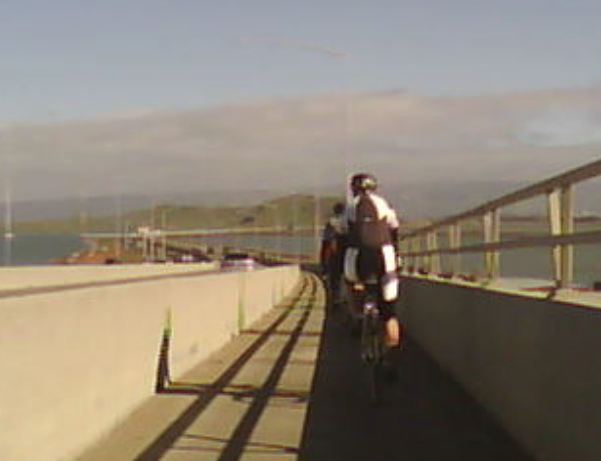
As promised, a couple of words about road quality: Yes, the frontage road after the Dumbarton Bridge is somewhat crappy. (It's scheduled to be resurfaced after the seismic retrofit on the bridge is completed later this year, but we'll be riding it again at least once before then.) But it's also a good simulation of what we experience in much of rural Santa Cruz and Monterey counties in June.
Outside the Santa Cruz and Salinas metro areas, the rural roads on Days 2 and 3 are often not in the best condition, and the chip-seal jobs have been deteriorating in recent years. Again, this can put you in a foul mood if you're not prepared for it. Also, suboptimal roads demand that you pay particular attention to the road in front of you so that you can avoid potentially harmful ruts, holes, and bumps. This means leaving enough distance between riders so that you can see what's in front of you, calling out road hazards for others, and riding single-file so that you have enough room to maneuver when necessary.
But all in all, today's ride went extremely well, and everyone was back in Mountain View ahead of schedule. Our next ride is vastly different.
In two weeks, on February 9, we'll head up the Peninsula to San Mateo for a street I've never put on a training ride until now: Parrott Drive in San Mateo. It's got a somewhat challenging climb, but it is a very doable climb. And even in a worst-case scenario, it's only 0.8 mile, and you could walk it in 20 minutes or less. So any cycling time less than 20 minutes will be a win! (And for those who have done my rides in previous seasons, Parrott is easier than Westridge, Joaquin, or Harder, so don't stress out.) My ride description talks more about Parrott in detail, and there's a video of my recent ride up Parrott, so you can see exactly what it's all about. You can do it!
The rest of our next ride isn't flat, that's for sure ... there are a couple of other attention-getting climbs, so it's a good day to work on pacing yourself. I've left the official pace at Cat-2 to try to relieve some of the time pressure, so don't worry. Find out more and RSVP here.
Next Saturday, however, don't forget the ALC kickoff party and expo in San Francisco, starting at noon in the County Fair building at Golden Gate Park. In a change from previous years, there's no official ride associated with the expo, but there are a few rides out of Sausalito and Orinda early in the morning, so you can still ride and be in San Francisco by the afternoon. Parking can sometimes be challenging in the park during the weekend, especially later in the day, so you might want to consider some creative transportation plans such as Muni or even parking elsewhere and riding to the event. An RSVP is required for this event, so sign up here.

Many of the common cycling apps can perform elevation correction, either by default or optionally. With elevation correction enabled, the apps ignore the altitudes reported by your devices and instead use massive topographic databases. This usually -- but not always -- yields more accurate and consistent information. That's one of the main reasons why ALC doesn't post official climbing stats for the route: Every app has its own way of doing things, and they most definitely do not agree with one another. For your own training, the best advice is to stick with the calculations from one app and use those as the basis of your comparisons.
When I report climbing stats, I usually use Strava, although I sometimes use Ride With GPS -- but correcting for the usual 10% to 15% inflation that RWGPS reports when compared to Strava. So when you see a training ride on the calendar that claims "9,000 feet of climbing," you might want to ask about the source of that number. I can safely promise that I'll never, ever schedule an ALC training ride with 9,000 feet of climbing according to Strava! This doesn't make the other rides evil; it just means that they're consistently using a different data source ... and, again, that's why there's no one official source of climbing data.
So much for the geekery! Thanks again for riding today, I hope you'll join us again in two weeks, and thanks for being part of AIDS/LifeCycle.