Upcoming rides I'm leading:
Nothing on the schedule.

Show blog entries about: Upcoming rides | Ride reports | My own training
Showing posts with label ridereport. Show all posts

Ride report: Double Bay Double 4 (9/27/2014-9/28/2014)


With a new route, the fourth Double Bay Double has gone into the history books as another successful event. Our 12 riders and and seven volunteers made it all the way from Sunnyvale to Marina and back without any significant incidents, and we have so far raised more than $10,400 to support the San Francisco AIDS Foundation.

In fact, after having unpleasant weather surprises in every previous DBD, we were extremely fortunate this year that temperatures were moderate throughout the weekend and (sadly for the state's drought) the most precipitation we faced was just a few scattered sprinkles on part of Day 2.

Day 1: Sunnyvale to Marina

This year's event start/finish moved from Mountain View to Sunnyvale because of new parking restrictions related to Levi's Stadium. We took the opportunity to move the start a few miles to the southeast in Sunnyvale -- still "near" the bay -- and this gave us some newfound flexibility in designing 100-mile routes for both days of the event.

For starters, we began Day 1 by riding nearly the full length of Lawrence Expressway southbound. During commute times, such a move would be stressful at best and dangerous at worst. But at 7 a.m. on a Saturday, things were relatively calm, and this allowed us to get out of the city and into the hills much earlier in the day, and with far fewer stop signs and traffic signals. One rider got a flat tire along this stretch, however -- a theme that would recur throughout the day, mostly due to the rain that fell the previous two days and left scattered debris on shoulders across the area.

Soon enough, we were amid the rolling hills (and palacial estates) of Saratoga, and we quickly took our first rest stop before starting our big climb of the weekend.

Highway 9 out of Saratoga, which tops out at more than 2,600 feet above sea level, is one of many benchmark climbs for area cyclists. The climb of nearly seven miles usually is uninterrupted and is moderate but rarely steep. But two sections of road work this year meant that most cyclists had to wait several minutes at one or both locations before the traffic signals allowed them to proceed on the one-lane sections of highway. This might have been bad for setting any personal speed records, but it was also a very good thing for us because it forced most riders to take some breaks during this long climb, preventing people from burning out so early in the weekend.

The top of Highway 9 is where most cyclists reach their peak and begin to head back down. But not us! We took advantage of the very helpful water (and snack) stop that AIDS/LifeCycle had set up for us (and where just the tiniest wisps of fog had finally arrived), and then we headed south on Highway 35 (Skyline Blvd.) for even more climbing, all the way to a peak of about 3,163 feet above sea level.

There's only one way to go from there, and that's downhill ... and that's where many of our riders had the most fun of the weekend. That part of Skyline usually isn't part of training rides or events, so it was completely new to many of our riders and volunteers. Over the next 10 miles, the road gradually gave back about 1,400 feet of elevation -- and it turned into a narrow, desolate, almost traffic-free one-lane road that offered amazing panoramas of the Santa Cruz Mountains. Sure, there were a few little intermediate climbs -- some of which even called for the granny gears to come back out -- but this part of the ride easily won the most compliments, including "best road ever."

One rider apparently liked this descent enough that they kept going down Bear Creek Road instead of turning onto the last two miles of one-lane Skyline. They ended up all the way down at Lexington Reservoir (elevation about 700 feet) near Highway 17! Making them climb back to the summit would have just been cruel, so one of our support vehicles rescued them and brought them back on course.

With all of the different jurisdictions we travel through, it's tough to keep track of road work. After crossing Highway 17 onto Summit Road, we got a bit of a rude surprise when we found that a few miles of the road had very recently been chip-sealed.

The surface had been sealed, but there was still plenty of loose gravel and even more blowing dust that whipped us every time a car or truck passed us. So as we pulled into the second rest stop at Summit Center, many of us were ready to take a break.

After the break, however, we were still about 1,600 feet above sea level, and we needed to get to the metro Santa Cruz area. What did that mean? More descending! Also new this year was our 11-mile descent of Soquel-San Jose Road, a glorious, fast route that most of us also enjoyed. Better yet, after all that descending, we arrived in Soquel for Rest Stop 3, fairly well-rested and ready to keep going, almost as if the day wasn't already half over.

With a new route out of Soquel via Trout Gulch and Valencia roads, we quickly escaped the hustle and bustle of the city. A little more traffic built up as we approached Watsonville, but our new bypass route this year allowed us to avoid the sketchy shoulders and traffic signals of previous years. As we turned onto Highway 129 to head east for a few miles -- with a gloriously smooth and wide shoulder -- the winds picked up out of the west, giving many of us an effortless, quick ride to Murphy Crossing Road. With only a few roads crossing the Pajaro River, our choices to get across the river are limited, and Murphy Crossing was the best of a suboptimal set of options: rough, pitted, potholed, with heavy agricultural traffic. Fortunately, it only lasted a couple of miles, and it was mostly flat, but most of us were happy when it was over.

A short but attention-getting climb up San Juan Road took us to the turnoff for the tiny community of Aromas, into which we descended for our final official rest stop of the day. The toilet inside the Aromas Free Library was appreciated by many, as was the friendly and helpful staff that greeted many of us.

Aromas also marked another division in the day's route, from mostly flat back to somewhat hilly. A somewhat tough climb greeted us right out of the gate as we left Aromas, and we ended up back on San Juan Road -- but heading in the opposite direction to what we'd been doing earlier. (Fortunately, none of the riders noticed that they could have saved several miles by skipping the whole side trip into Aromas ... or, at least, none of them felt the need to do so.)

Our last long climb of the day was San Miguel Canyon Road, a mostly moderate climb that was a bit easier thanks to more tailwinds. The reward this time was an equally long, equally moderate descent into Prunedale, where friend-of-DBD John had set up a secret water and snack stop for us, which was a most pleasant surprise. The skies had become noticeably more dark, and a few drops of rain even fell on some riders around here.

The route from Prunedale to Castroville was also new this year. Blackie Road started out fun enough, with a moderate climb on a smooth road with a nice shoulder. But conditions gradually gave way to more of what one expects in rural Monterey County: a rough, narrow road with no shoulder. Moreover, now that we were heading westward, the winds that were helpful tailwinds earlier in the afternoon had become annoying headwinds.

Speeds dropped for many riders during this stretch, and many of us were even pedaling downhill to keep up our speed. The headwinds didn't let up on the bike path out of Castroville, so we were more than ready to take one more unofficial break at Pezzini Farms, home of the famous ALC artichoke stop, even though we were just five miles from the end of our day.

Del Monte Blvd. into Marina is the same road that it's been for many years: rough in places with a bike lane that's serviceable at best. Some of us stopped at the Marina city limits sign for ceremonial pictures, but others were more than ready to get to their hotels as quickly as possible.

That, however, didn't stop a few riders from adding a few bonus laps around the parking lot -- or riding to the beach and back -- to make sure that their bike computers registered a full 100 miles for the day.

The last riders -- one of whom was completing their longest, most difficult ride ever -- arrived well before the official 6:30 p.m. route closure, and the usual collection of small groups formed to head to area restaurants for dinner. This year, several of the riders and volunteers decided to congregate in the Comfort Inn lobby to feast on delivered pizza and salads -- a good choice for those who wanted to eat more than the standard restaurant portions, a not-so-good choice for one rider who ate a little too much and got an upset stomach, causing them to skip riding Day 2.

Day 2: Marina to Sunnyvale

As usual for Day 2, I was awake before 5 a.m., expectantly looking outside in the dark for signs of the dense fog that has plagued us many times in the past. This year, however, the fog was nowhere to be found, temperatures were in the low 60s -- much warmer than usual -- and there was almost no wind. All the ingredients were there for a perfect ride-out.

After a brief announcement that our fundraising total had increased by about 10% just overnight, we got underway a couple of minutes before the official 7 a.m. start. Because we were riding one week later than we did last year, headlights and tail lights were most helpful.

Although one rider had a flat tire in the first segment (not really a surprise, considering all of the dirt and gravel in the bike lane due to agricultural traffic), we mostly made good time into Salinas on the almost-complete new bike lane along Davis Road. After a quick Starbucks rest stop, we headed north for our big climb of the day: San Juan Grade.

Skies continued to be gray, and the hills were as barren as ever as we climbed to just over 1,000 feet above sea level, where friend-of-DBD John was again waiting with water and snacks. The descent on Salinas Road was at least as rough as ever, but traffic was a little bit lighter than in previous years.

I often gripe about the absolutely horrible condition of this road, but I remind myself that if the road were resurfaced, then more people would use it as a bypass of U.S. 101 (it was the original 101 until the late 1920s), and they would undoubtedly do so at much higher speeds. So I think we're stuck with it.

As we left our next rest stop in San Juan Bautista and headed east, we could see several patches of low clouds -- or was that light rain? -- on all sides around us. As we went around the west side of Hollister, we reached the easternmost part of our route, which is farther east than the state Capitol building in Sacramento.

A left turn onto Highway 25 started us back toward civilization, and we were very fortunate again this year to have nearly no wind on this segment of road that's notorious for intense headwinds.

By the time many of us reached Gilroy, the skies were dropping liquid on us -- whether it was heavy mist or light sprinkles is open for debate -- but that also meant that temperatures were unusually cool, which was a relief compared to the often-hot conditions in the South Valley.

One rider decided to leave the event in Gilroy with the usual collection of cyclist aches and pains, but the rest of us continued forward.

The streets of Gilroy provided a brief change back into city riding, and we headed north out of town on a new route this year that skipped much of the narrow, high-speed Uvas Road in favor of a direct route along Santa Teresa Blvd. into a new rest stop in Morgan Hill.

Temperatures were starting to warm up, and I exchanged my windbreaker for arm warmers as I left town. But just a couple of miles later, the sun suddenly emerged from the clouds, and things warmed up dramatically and quickly.

Just as quickly as the arm warmers went on, they came off, and we were treated to beautiful weather as we saw the amazing and sobering sights of the almost-empty Chesbro Reservoir, complete with a bridge from the original road that was submerged in the mid-1950s when the dam was built.

After a short climb on McKean Road, John was there to surprise us one last time with goodies. (My apologies for the error on the route sheet that misplaced the name change from Uvas to McKean.) Then we were back among the big-city roads and traffic of south San Jose as we entered our final rest stop of the event, where friend-of-DBD Debi had showed up to provide frozen Otter Pops in the increasingly warm afternoon.

There were still about 22 miles to go, but this year's new route back to Sunnyvale only had one significant climb: the ascent of Camden Avenue. After that, it was fairly easy riding back into Los Gatos and north into Campbell, where we began the event much as we began it: with a fast ride of several miles on a county expressway (San Tomas this time) directly back to Santa Clara and Sunnyvale, skipping most of the traffic signals and all of the stop signs on the side streets of previous years.

And for the second day in a row, everyone was done long before the official 6:30 p.m. closing time. Some participants assembled nearby for hamburgers, others went home, and everyone got ready to emerge from the mini love bubble and return to the real world.

Random observations

A total of 12 riders began this year's event, and 10 finished. Each of those 10 rode every mile of the route. It was another safe event -- no crashes or injuries -- and we had only a few of the minor mechanical issues and flats (and one blowout) that pop up on any event. Our riders deserve special commendation for riding safely and obeying all the rules of the road and of the event.

To me, although this year's route was still quite challenging, it seemed slightly easier than those of previous years -- just as I intended. Cutting the length of Day 1 back to about 100 miles also helped considerably and got everyone to Marina well before the 6:30 p.m. closing time. And on Day 2, the new route between Gilroy and Morgan Hill eliminated what, for me, was the part of the ride where I often hit my proverbial performance wall and started to dread the rest of the day. Of course, the generally favorable weather this year almost certainly helped as well.

Also, I was pleased that the new route along the crest of the Santa Cruz Mountains on Day 1 got generally high marks. One of my big goals this year was to offer scenery that's not often seen on training rides and other events, and I think we delivered in high style. And by arriving at the coast in Soquel, we were able to bypass much of the heavy Santa Cruz traffic that has hounded us in past years.

Again this year, our volunteer team did an amazing job of supporting our riders. Big thanks go to volunteer coordinator Taryl, and to Brendan, Brian, Clyde, Irene, Dale, and Andrew, plus friends-of-DBD John, (another) John, and Debbie for added support and encouragement along the route. Even though we had no serious incidents, it's impossible to overstate the immense value of seeing a friendly face in an unfamiliar place and knowing that help is there if we need it, even if we don't. We couldn't have done it without you.

Thanks are also due again this year to Different Spokes San Francisco, which provides the legal framework under which the ride can exist. Without this structure, the ride couldn't happen.

The several months of work that I put into organizing and producing DBD always motivates me; the summer of training rides gives me something to focus on; and seeing the many riders, volunteers, and supporters come together for a good cause every September moves my soul. But I would be remiss if I didn't acknowledge at least some disappointment that this year's event wasn't nearly as large as I had hoped.

Our attrition rate this year -- riders who registered for the event but did not ride or fundraise -- was more than 50%, even excluding those who registered as riders but later converted to much-needed volunteer roles. (In fact, many of our non-riding volunteers did significant fundraising this year, including -- as of this writing -- top fundraiser Andrew Bennett, and for that I'm extremely grateful.) The reasons were many: injuries, insufficient training, or just simply life happening. And since we have no actual event "staff," we don't spend much time on what the event professionals would call "retention," so it was mostly just a confluence of random events that kept this year's event small.

Nevertheless, in retrospect, I wish that I had been able to invest more time in promoting the event and attracting (and keeping) new and returning riders alike. And while more than $10,000 for the San Francisco AIDS Foundation is definitely something for our small group to be proud of (as is the more than $50,000 that DBD has raised for the foundation since it began), I'm sorry that I wasn't able to bring more money to the foundation this year, especially considering all the behind-the-scenes help they give us every year to run registration and fundraising.

Even though our numbers were small this year, the camaraderie among us was out in force, and our own "mini love bubble" encased us for the entire weekend. DBD is a magical event, and I'm proud to be part of it. But I'm just one part; everyone who comes together to support SFAF and one another -- through riding, volunteering, donating, supporting, or just thinking good thoughts -- provides the real magic.

And in a world that's increasingly difficult for many, it's refreshing to escape the tribulations, even if only for a weekend, and especially while doing good for others. Thank you to everyone who's been part of DBD.

Photos by DBD participants and friends

Ride report: Double Bay Double 3 (9/21-22/2013)


The third Double Bay Double is successfully into the history books! Our 20 riders and 16 volunteers have raised more than $15,000 (so far) for the San Francisco AIDS Foundation, and everyone ended the ride safely. Our weekend was full of fun, surprises ... and some epic challenges.

In the pre-ride orientation that all DBD participants view, there's a slide that says in part: "If unexpected things happen (and they will), go with the flow." It's become part of accepted DBD wisdom that "unexpected things happen" every year, but nobody (least of all the National Weather Service) expected the torrential rains that soaked us partway through Day 1 this year.

Day 1: Mountain View to Marina

Our day began quietly enough after a few showers moved through the area overnight, keeping temperatures a little warmer than usual and keeping the fog to only the highest elevations of the coastal hills.

We headed out about 10 minutes earlier than planned, hoping to get a head start on what we thought would be a few light sprinkles later in the day. But the roads were still wet in places, and we got a stark reminder of that less than 1 mile into the ride, when our route out of Mountain View along California Street was blocked in the oncoming direction by a serious vehicle collision that had occurred not too much sooner.

Otherwise, though, our ride through Mountain View, Palo Alto, and Menlo Park was mostly uneventful, and we were soon on our way up Old La Honda Road, the biggest climb of the weekend.

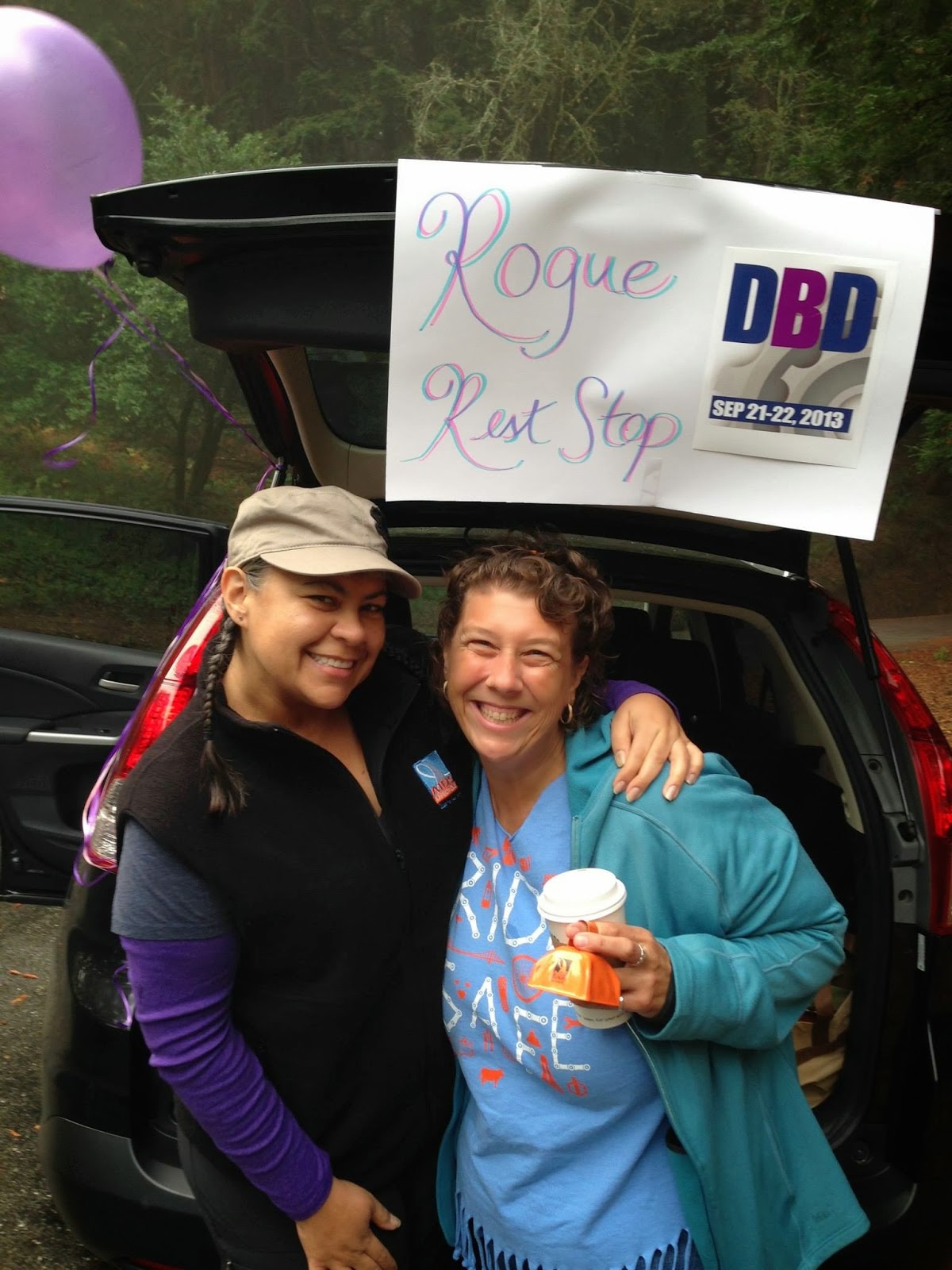
Although the road gradually went from "a little wet" to "mostly wet," the rain was holding off, and there wasn't much fog until right before the summit ... where the surprise "Rogue Rest Stop" was waiting for us, staffed by Frank, Diana, and Terri and providing a much-needed collection of smiling faces and delicious snacks.

A long, gradual descent took us through La Honda and into the first rest stop of the day at Sam McDonald County Park, a new location for us this year. Instead of being the quiet, secluded location I'd scouted out during route planning, the parking lot was full of Boy Scouts and scout leaders about to embark on coastside adventures.

Most of us quickly refueled and refreshed and got back on our way to the top of Haskins Hill and on the gloriously long descent into just outside Pescadero.

By this point, the skies were becoming decidedly dark, and our first riders started to feel their first raindrops as they headed into a strong -- and somewhat unusual -- headwind out of the south past Butano State Park and onto winding, narrow Gazos Creek Road. As we neared the junction of Gazos Creek and Highway 1, a welcome sight awaited us: the colorful tent of the San Francisco AIDS Foundation, set up across the highway at the ocean access parking area. (It was visible from quite a distance!)

Robin and Morgan of SFAF were there, and (just like the rest of us) had no idea what they were getting themselves into. The wind was whipping, blowing over bicycles and box lunches, and making it difficult to secure the tent.

Then the rain started.

It was light for the first few minutes, but it quickly intensified. Soon it was torrential, cold, and potentially dangerous. The first few riders had already headed onto Highway 1 toward Santa Cruz, but the rest were trying to huddle under the tent, shrouded in emergency rain ponchos. Meanwhile, on the road, conditions deteriorated rapidly. At mile 50, the rain was heavier than I'd ever encountered during a cycling event, so I pulled into a rest area and took brief refuge in a public toilet (one that was large enough to also hold my bike) as the worst of the heavy rain crashed onto the corrugated metal roof.

After a few minutes -- and a quick check of the weather radar on the cellphone -- I decided that the worst was almost over, and I got back on the road, but conditions were still poor at best. A couple of our support vehicles went by me and pulled over, and we had some discussions about what to do. I said to one, "ALC has been shut down for less than this!"

Shutting down a day of DBD would have been a difficult proposition at best, since we aren't normally equipped to transport all (or almost all) of our riders and their bicycles. We started making some phone calls to put possible rescue drivers on standby.

Meanwhile, back at Gazos Creek, some of our riders made the decision to not attempt the route between there and Davenport (where Kiki and friends were waiting by the side of the road at our next rest stop), and our vehicles were able to accommodate them. I was facing a tough call: Do we shut down the ride? Finally, I decided not to do so at that point; those who wanted to continue were doing so anyway, and those who wanted to get a ride were also doing so. One thing I did not know at the time, however, was that there had been at least two serious vehicle collisions behind me on the rain-soaked Highway 1. Had I known that, I might have made a different call.

Eventually, the rain gave way to just some scattered showers. By the time the first riders entered the west side of Santa Cruz, the streets were dry, suggesting that it hadn't rained there at all. The day started to look better, but then the skies opened up yet again, and an equally torrential rain began to dump on the Boardwalk area. Just before some of our riders went through the area, a vehicle went off the road and through a retaining wall onto the beach below.

By the time riders began to roll into Rest Stop 4 in Aptos, things were getting serious. Fortunately, the first riders in the group had decided to take an extended break there, so nobody had gone beyond that point. We detoured our gear transport vehicle -- which should have already been set up in Marina to serve arriving riders -- to the rest stop (sorry about the confusion on the location!), where riders were able to access their bags and change into their Day 2 cycling clothes if desired. (In my case, doing so probably kept me from shivering myself into sickness the rest of the day.)

Although the showers were still popping on and off in Aptos, the weather radar indicated that the storm was quickly passing through to the north. We pressed forward toward Watsonville and our final rest stop, where skies were finally rain-free. But the winds were still annoyingly out of the south, and our final segment around Elkhorn Slough and Castroville was slowed considerably. By the time we reached the end of the day's route in Marina, we had just about every emotion in the book: relieved, exhausted, tired, grumpy, excited, triumphant, and on and on.

Beginning in Davenport and continuing through Aptos, bike tech volunteer Aron put in a stellar effort to keep our bicycles running. Like the rest of us, he couldn't have imagined what we were getting into, yet he set up his work area and rack outside the Comfort Inn in Marina, where he offered to work on each and every rider's bicycle, cleaning drivetrains and doing whatever else was necessary to keep us on the road.

It's not an understatement to say that many of us could not have completed the event (myself included, after my rear brakes disintegrated in Santa Cruz during the storm) without Aron's help.

After such an epic day, many of us were tired and sore. But another 100 miles awaited us.

Day 2: Marina to Mountain View


It would have been tough to outdo the excitement of Day 1. But by this point, many of us were quite happy to be without such excitement.

As mornings in Marina go, Sunday was just about picture-perfect. No fog, temperatures cool but not chilly, and almost no wind. So our spirits were up as we headed out of town on a slightly new route that avoided road work in the hotel area.

We made reasonably good time into our first rest stop at Salinas, and after an extended serenade by a canine duo in the parking lot, we began our annual assault on San Juan Grade.

Under mostly favorable conditions, the ascent was about as painless as it can be, and many of our riders set personal-best times. The descent, of course, is still the same rutted, bumpy, patched, cracked 80-year-old pavement, but there was one added attraction this year: A large herd of cattle had gotten loose overnight and were defiantly occupying the middle of the road. (And from the, er, deposits strewn across the road, it was clear that they had been there for quite some time.)

Loose cattle are not to be trifled with! A couple of riders reported that a cow made a moooove on them. Some of us saw the police cruiser headed up the hill from San Juan Bautista, presumably on its way to corral the wayward herd.

The ride from San Juan Bautista to Gilroy can be windy and challenging, but many of this year's riders got a special treat: a slight tailwind on Highway 25 that allowed us to quickly dispose of that 6-mile segment of busy, straight, and flat highway through the fields of rural San Benito County.

In true South Valley fashion, however, the winds began to increase as the day wore on. After our lunch stop in Gilroy, the winds turned from the north and picked up. The first riders of the day didn't have too much difficulty around Uvas and Calero reservoirs, but that wasn't the case for those who got there as the afternoon progressed.

Again this year, the fine folks of South Bay Blaze set up a bonus rest stop for us at the end of the reservoir segment, just before we reached San Jose. "Rest Stop 4.5" was a fun-filled and much-needed respite from the wind, and it put riders into good spirits as we began our last 30 miles through the urban byways of the South Bay.

After 180 miles, the weekend was beginning to take its toll. A couple of riders missed a key turn on Almaden Expressway and ended up with about 14 bonus miles! Another went the wrong way after leaving Rest Stop 5 in Los Gatos and picked up some extra distance as well. But everyone eventually got back on track, and the last rider of the day successfully crossed the finish line in Mountain View at about 6:25 p.m., a job well done.

Random notes


Of the 20 cyclists who began the ride, 19 finished under their own power. One rider had to end early after some minor medical issues, several riders were transported through the worst part of Saturday's storm, and one other rider began Day 2 mid-ride. We had our first vehicular casualty in the event's history: Our caboose vehicle broke down early on Day 2 and had to leave early to limp back to the Bay Area. Thanks again to our volunteers, who quickly and adroitly shuffled responsibilities to keep the route covered.

The story of our journey inspired many. Kudos to the passer-by who gave us a $20 bill at the Gazos Creek rest stop. And during dinner in Marina, the owner of the restaurant where many of us ate returned with $50 in cash after hearing about our day. (Both of those donations will be employer-matched and, therefore, doubled.)

When I began to organize DBD3 several months ago, I was hoping we'd reach our no-permit limit of 50 riders. That didn't happen this year, due in part to a crowded event schedule and a last-minute shift in the date of the Surf City AIDS Ride (which shared part of Sunday's route with us, although we passed through the area before any of their riders did so). That was a bit disappointing for me, but a smaller event allows me to do things that I couldn't easily do for a larger group. We had plenty of amazing volunteers this year, but they would have been spread too thinly if we had twice as many riders.

On the plus side, however, our increased social media presence this year has definitely spread the word about DBD. And again this year, we were safe. Everyone did what they felt necessary during Saturday's storm, those who had difficulties didn't try to ride every mile, we stayed mindful in difficult traffic, and no ambulances had to be called.

After three years, DBD has grown well beyond my original vision ... and it's done so organically, made possible by the event's cyclists, volunteers, and friends. The level of support during the event has increased to a level I didn't think possible, and that's entirely due to the determination and effort of the many volunteers who have been part of DBD -- and who have often had to deal with the lack of structure and organization that is common on larger and more established events. I continue to be amazed and impressed that so many people get together and simply do the right thing to empower and support one another for an entire weekend. And I continue to be impressed that all of our riders and volunteers help fund the event so that every dollar raised can go directly to the San Francisco AIDS Foundation. Thanks also go to Different Spokes San Francisco, who continue to provide the legal framework without which DBD would not be possible.

Our DBD orientation slides also say: "Remember why we're here." For everyone who is part of DBD -- cyclists, volunteers, supporters, family, friends, and everyone else -- thank you for again allowing us to remember why we're here.

Photos by DBD3 participants and friends

Ride report: 6th annual Altamont Pass Double Metric (5/4/2013)

Go, riders!

After six years of hosting the Altamont Pass ride, the one thing I've learned is that each ride presents its own unique set of challenges. This year's ride was no exception, but our intrepid group of 15 riders and six volunteers conquered the challenges and turned in excellent performances.

Each rider returned to Mountain View under their own power, and only one rider chose to get a lift between two intermediate rest stops ... although one rider started to head the wrong way down Altamont Pass toward Tracy! That would have been a lot of bonus miles.

Speaking of Altamont Pass, we were treated to something that had never happened before on this ride: backwards winds. The climb to the top (which, as you discovered, wasn't all that much of a climb anyway) was a little more difficult, but the descent was quite literally a breeze, thanks to the unusual winds out of the northeast. This also made our return across the Livermore Valley quite a bit easier than usual, although the rapidly increasing temperatures began to pose their own challenges as the day progressed.

Although no temperature records were broken, highs were running about 10 degrees above normal in the East Bay. If you haven't had much heat training this season (and, given our wacky winter weather, that's not surprising), you might have been caught off guard by how your body reacted to the heat. In my case, my fluid consumption went way up, so much so that I ran out of water just before the Hayward rest stop -- something that almost never happens to me.

Another thing that happened to me in the heat was that I found myself taking many more short stops than usual between the official rest stops. There's no shame at all in doing so. I also took care to replace not just water, but also electrolytes and sodium. I slowed my pace a bit; while it would be exaggerating to say that I went into "survival mode," there was a part of the afternoon where I simply wanted to get through the miles without damage, and I took extra care to listen to what my body was saying. It's rarely wrong.

On the event in June, we've been fortunate the past few years to have unusually cool temperatures. But it's entirely normal for afternoon temperatures to reach into the 80s or even the 90s on several days of the event. Also, just like yesterday, many days of the event pass through several microclimates. You can go from cool to hot to cool to hot again all in the same day, and you might even be taking your jacket off and putting it back on multiple times. Remember the lessons you learned yesterday, and put them into practice next month. (And take note that midday temperatures can sometimes be surprisingly cool despite a warm start: When we leave Paso Robles on the morning of Day 4, it can be bright and sunny, but it can be foggy and damp just 20 miles later as we descend to the coast.)

I also want to take a couple of minutes to thank all of our volunteers on this ride. We were extremely fortunate that we had nothing more serious than a couple of bicycle adjustments, shuttling one rider, and handing out lots of water and salt. I want to assure all of the volunteers that your presence was definitely needed and appreciated; it's impossible to overstate the sense of security that's present when you know that people are available to help if an incident occurs. (And, as Murphy would attest from several previous rides, the lack of support volunteers often happens precisely on the rides where they end up being needed the most.)

Trivia department: I can answer one of the questions about the two unexpected events we encountered along the way. The crowd at Quarry Lakes Regional Park in Fremont in the morning was the Western Pacific Marathon/Half Marathon/10K/5K.

But I am flummoxed by the cycling event we saw going the other way between Livermore and Pleasanton in the morning. I can't find anything about it online, and given that many of the participants had the same jersey and they had ribbons of different colors that suggested multiple routes, I would think that it would have been announced somewhere. Any ideas?

A ride of 200 kilometers is your introduction to the steeped-in-tradition world of randonneuring: long-distance, unsupported, non-competitive cycling. In this country, Randonneurs USA is the main organization in this sport that traces its origins all the way back to late 19th-century Europe: "The first recorded audax cycling event took place on June 12, 1897, twelve Italian cyclists attempted the challenge of cycling from Rome to Naples, a distance of 230 km." RUSA rides often feel much like ALC rides, with the same spirit of camaraderie ... but generally without the high levels of rider support we have. RUSA membership is a bargain at $20 per year; the quarterly print magazine American Randonneur is worth the price alone just for the ride reports and cycling tips.

Two randonneuring groups in this area are Santa Cruz Randonneurs and San Francisco Randonneurs; each offers a series of events year-round. But where my training rides stop at 200km, the RUSA rides are just getting started, with distances of 300km, 400km, 600km, 1000km, and 1200km -- the distance of the legendary once-every-four-years (next in 2015) Paris-Brest-Paris. Many ALCers are RUSA members, and it's not uncommon to spot ALC jerseys on their rides.

What's next for us? In past years, I'd be saying thank you and wishing you all well in June. But this year, thanks to the unusual schedule and the unusual weather, we've got one more ride on the calendar. On Saturday, May 18, we'll have our first-ever celebration ride. Because these are the Distance Training rides, it wouldn't suffice to get all suited up just to ride up the street to the next Starbucks. Instead, we're going to tackle one of the more challenging and incredibly scenic rides of the South Bay: the ascent of Highway 9 to Saratoga Gap. Then, we'll descend the west side of Alpine Road toward the coast and climb back up and over Highway 84. This ride is "only" 62 miles; there are really only two significant climbs the whole day, but that adds up to almost 5,000 feet of climbing. The good news is that there are no surprise climbs at the end of the day; we'll proceed directly down Alameda and Foothill to Loyola Corners with no detours. The meet time is also a comfortably reasonable 9:30, which means that you can take southbound Caltrain to this ride. What a treat! Find out more and RSVP here.

Congratulations on an epic day, and thank you for being part of AIDS/LifeCycle.

Photos by Andrew Bennett


Ride report: ALC12 Distance Training #9 (4/20/2013)

Go, riders!

Now that we've rocketed past the century milestone, each of our rides is nothing less than epic. Our group of 20 riders (including one who overslept but still managed to join us almost on time) experienced a little bit of everything yesterday: jubilation, excitement, wonder, frustration, and even some disappointment along our 113-mile route. Eighteen of us made it back to Mountain View under our own power; we had one minor collision and one minor medical issue, but nothing serious. Big thanks to super SAG driver Keith and rest stop volunteer Tom, without whom the day would not have been possible.

We got to see a little bit of everything that the South Bay (and beyond) has to offer: the big city, small towns, agricultural flatlands, rolling foothills, secluded highlands. And we got to do a lot more open-road cycling than we're normally able to do on our rides closer to home. This was a significant change for a couple of reasons. Your overall pace might have gone up a little bit because you weren't stopping and starting so much. But also, riding nonstop for miles on end can feel a lot different if you're not used to it. Those of you who were riding with me from San Jose to Morgan Hill in the morning saw this when, after several nonstop miles, I simply couldn't maintain my ambitious pace any longer and had to let you go on by.

There's nothing wrong with slowing down during a long segment ... or even stopping safely to take a short break. If your sense of pride interferes, just whip out your camera or cellphone and tell others that you're taking a photo break! (But be sure to take plenty of true photo breaks, too. There's a lot to see between here and Los Angeles.)

This ride also strongly demonstrated the need to pace oneself. We started with 40 miles of almost perfectly flat riding, some of it even assisted with a generous tailwind that started at just about the optimal time. Early in the day with full energy reserves, it's tempting to open up and give it everything you've got, especially if you find flat-terrain cycling to be not the most exciting thing in the world. But, of course, we had plenty of climbing after that, including the return around the reservoirs that, to me, always ends up being much more difficult than the numbers suggest, no matter the ride.

That's also the case in June. While there's no shortage of climbing, there are also many stretches of long, flat cycling ... and once you've seen your first 63 agricultural fields, it can seem like you've seen them all. But endurance, not racing, is our long-term goal. Sure, it's OK to naturally go a bit faster on flat terrain, but if you're monitoring your heart rate either electronically or informally, my guess is that you probably don't want to be hitting your peak heart rate on flat terrain in the middle of nowhere.

I mentioned frustration and disappointment, too. Any time that you don't complete a ride as planned can wreak havoc with your head. Even though we aren't racers, many of us take a dreaded DNF (Did Not Finish) personally and let it fester into all sorts of toxic manifestations.

Last Saturday, I went to an 80-mile ALC training ride on our off weekend, and my ride did not go well at all. I finished every mile, but I was grumpy and sore at the end, and my body didn't get back to normal for several days afterward. I went out on my bike a few times in the past week, but each time, it felt like 30 or 40 miles was my limit, and by the end of each ride, I really wasn't wanting to go another foot. I was more than a little concerned that I wouldn't be able to complete yesterday's ride, and I had formulated backup plans to sweep the whole day or even drive a SAG vehicle myself. I had talked myself into believing that I couldn't do it.

Of course, I did complete yesterday's ride, and I finished strongly. My stats compared to last year were about the same. (See the "nerd detour" below.) The part of the ride from Gilroy back to San Jose was certainly difficult for me, but when I realized that I was going to make it, there was a sea change in how I approached the rest of the ride.

The moral is that most of us have bad days, and you can't let them get to you. Alas, I'm also well aware that it's much easier to say this that than it is to do this.

(Stats nerd detour: Last year, I recorded my ride with the Strava Android app. Yesterday, I recorded both on Strava and on my Garmin device, mostly because I was worried that the battery on the Garmin wouldn't last the whole day. The Strava stats showed me about 3.5% faster than did the Garmin stats -- something I've consistently seen when recording other rides with both devices. Again, the moral is that any of the stats we record using GPS devices are inaccurate and are only estimates, and it's generally not helpful to get bogged down in the precise details, but rather to look at long-term trends.)

What's next? It's the big one: the sixth annual Altamont Pass Double Metric. Our 200-kilometer (125-mile) journey takes us into the East Bay for the world's longest one-day ALC training ride. Like yesterday, it's a giant mix of urban and rural conditions ... but it has a little less climbing than yesterday's ride, and no giant hills at all. The biggest climb is the short westbound climb of the Dublin Grade, which is over in just a few minutes (last year, for me, 12 minutes).

The weather is the biggest factor in determining how tough the Altamont Pass ride can be. We've had days in the 60s, and we've had days where the temperature has exceeded 100 degrees. We've had light winds and strong winds. We've had a couple of light showers but, fortunately, no heavy rain. At two weeks out, it's rather pointless to make any predictions, but the early AccuWeather guess is suggesting cloudy skies, possibly cool temperatures, and perhaps some moderate wind.

Our meet time is 5:30 a.m., only half an hour earlier than yesterday, and you'll have until about 7:30 p.m. to complete the route. April has graciously volunteered to be a bike tech for us, and she'll be at our Livermore rest stop (mile 60) to take care of any mechanical issues that might arise. The route is mostly the same as last year, although we'll go back to riding through the McCarthy Ranch area on the way back instead of by the Great Mall, which was sometimes just a bit too stressful for so late in the day. We'll also ride a little bit more on Mission Blvd., now that most of the construction work is finally done after all these years. To find out more and RSVP, go here. (Also, I'm still looking for SAG drivers for the ride. If you know of someone who can help -- or if you'd rather drive than ride -- let me know.)

Thank you for being part of another epic day, and thank you for being part of AIDS/LifeCycle.

Ride report: ALC12 Distance Training #8 (4/6/2013)

Go, riders!

Cycling 100 miles in one day is one of the sport's signature achievements. Only a very small percentage of those who take up the sport ever complete even one century ride. But today, each and every one of our 22 riders completed Every Friendly Inch of our 100-mile route ... including at least three for whom this was their first century ever! Special thanks to SAG drivers Taryl (welcome back!) and Tom for being there when needed.

Calling any century ride "easy" wouldn't do justice to the amazing achievement this represents. But I believe it is fair to say that today's near-ideal weather certainly made things at least a bit "easier" for us, especially compared to last year's running of this same ride when temperatures soared to over 100 degrees.

And while today's route had (more than) its share of urban traffic, stop signs, and signals, everybody finished well within the time limit. Today's route was similar in difficulty and conditions to Day 4 of the event, so now we've done rides that are at least as challenging as six of the seven days of the event. We are in great shape with nearly two months to go!

Today's ride was not without its challenges, of course. We had several flats, many of which were no doubt caused by the vast amounts of broken glass and debris on the streets of the East Bay and San Jose. It seems as if this is becoming more of a problem for us, particularly in areas where budget cuts are affecting street maintenance, and particularly in areas where people seem to be acting more rude and inconsiderate of others. In June, fortunately, the route is checked each day by our awesome roadies, and most glass or debris is swept up long before we would ever see it. But that doesn't mean it never happens ... and when you're riding in a large group, it's important to call out (and, where safe to do so, point out) debris because other riders might not be able to see it.

There was only one significant climb today. But, unlike other rides where I've placed the big climbs near the beginning of the ride, today's climb was about two-thirds of the way through.

As climbs go, it really wasn't that bad, but even for me, it felt a whole lot different at mile 66 than it would have felt at mile 12. That's also a good simulation of what happens in June: While most big climbs are indeed early in the day, the day-after-day grind can make little hills feel much bigger later in the week. (And even the little McClellan Road hill probably felt a bit tougher than usual when I deviously placed it at mile 94.)

There are almost certainly no double-digit uphills on the event. I can't say that it won't ever happen, because it happened once a few years ago due to a rerouting, but it is definitely safe to say that we've done hills this season that are far worse than anything you'll encounter on the event.

As we get closer to the event, don't forget the ALC rules. I saw a few cases of side-by-side riding today, and that's not allowed on the event (even though, in a bike lane, it's legal in California). Remember that we need to leave a clear path for other riders to pass us. And don't forget to call out "car back," especially when we're not in a bike lane. There were a couple of times when I should have heard a callout from another rider. The ALC rules apply to all of us, regardless of our pace.

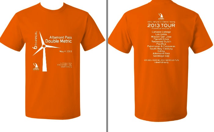
Because everyone on today's ride finished the entire route, each of you has now qualified to ride in this year's Altamont Pass Double Metric on Saturday, May 4 (just four weeks from today). If you RSVP by next Sunday the 14th, you'll also get a free commemorative T-shirt that will look great on you in camp. Find out more here. If you didn't ride with us today, you can still qualify by completing at least one ride of at least 100 miles before May 4.

And I just happen to have another chance for you coming up in two weeks! Join us on April 20 for our 113-mile ride all the way to Gilroy and back. We'll be using the same route that we debuted last year: through downtown San Jose and along Monterey Highway into Morgan Hill, then up into the hills near Gilroy Hot Springs, with a return around the south valley reservoirs. This is a fascinating ride, and it's just about as long and as hilly as Day 2 -- the longest day -- of the event. Find out more and RSVP here.

Note that the meet time for our next ride is 90 minutes earlier than today. (Ouch!) We meet in the dark at 6 a.m. and ride out at 6:30, just after sunrise. This helps us get through San Jose as early as possible before any traffic builds, and it gives us a full 13 hours of daylight to complete the ride (a little bit more than what you'll get on Day 2 in June), so nobody will need to feel pressured to go too fast. Pacing on such long rides is absolutely essential! I hope you'll join us for this memorable ride.

Congratulations again on a job well done today, and thank you for being part of AIDS/LifeCycle.

Ride report: ALC12 Distance Training #7 (3/23/2013)

Go, riders!

Well, that was certainly an interesting day, wasn't it? When rides start getting this long, it's almost guaranteed that something unexpected will happen. Our group of 22 intrepid riders had more than a few surprises today!

First on the list was the sudden (and, as far as I can tell, completely unannounced) start of road work on both sides of the Dumbarton Bridge access road. The milled-down pavement wasn't much fun, and the east end of the bridge in particular was no fun at all (Caution sign? We don't need no steenkin' caution sign) -- the big bump on the road caused two flat tires early in the day. I've got a query in to Caltrans to find out what I can about the project; two of our next three rides are scheduled to use the bridge, and if the whole frontage road gets torn up, I'll obviously need to change our routes.

Then there was the closure of Niles Canyon. Some of us waited up to half an hour at the entrance to the canyon to find out when we'd be allowed in after this morning's fatal head-on collision. I had quickly put together a backup plan that would have sent us up Mission Blvd. into Hayward -- but, just as I was starting to announce it to the group, the good-natured Fremont police officer on duty yelled, "Open!" and we were able to ride up the canyon ... and we even were given a bit of a head start ahead of the cars.

This type of incident, while rare, can happen on the event in June as well, so in a way, it was good for our training. Parts of our route can be temporarily shut down, especially when there's a serious incident. Hundreds upon hundreds of riders can back up quickly, and when the all-clear is given, it's just like another mass start in the middle of the day, with all of the associated crowding and danger. I've noticed over the years that event staff generally get a little looser with rest stop closing times when such holds occur, so don't stress out if this should happen to you during the event.

As if that weren't enough, we ran smack into the middle of a giant event at the fairgrounds in Pleasanton, complete with very heavy traffic and (as far as I can recall) the very first nasty, evil, Phelps-esque anti-gay protester I'd ever seen on a training ride. (Didn't see him? He was at the corner of Valley and Bernal just before Rest Stop 2 with his giant sign.) Although he clearly wasn't there because of us, I'm still trying to figure out why he targeted a hot rod and custom car show in Pleasanton.

If one is in a bad frame of mind at the time, encountering such a thing on a ride could be very disconcerting. I hope it didn't put anyone in a bad mood today; the bigger lesson to take away is all sorts of things could happen during the event to foul your mind-set -- poor weather, traffic, physical issues, and so on. During the event, it's very important that you let such things affect your mental state as little as possible, because once your mood has turned sour, it can be very difficult to rectify.

And then it got downright warm, much warmer than predicted, with temperatures in Pleasanton into the mid-70s. As the temperature goes up, it's important to take in enough fluids, including electrolyte replacement. In June, it's possible for afternoon temperatures to hit the 90s on some days (although this hasn't happened in recent years), so it's not a bad idea to do at least some riding in the heat before then to find out how your body reacts.

Then, as we descended into Milpitas, the winds came up, the skies turned hazy, and the temperature dropped ... almost as if rain was approaching (which it wasn't, of course). I started to mentally prepare myself for dealing with nasty headwinds all along the Tasman Drive slog through San Jose and Santa Clara. But fortunately, at least when I got there, the winds started to die down the closer we got to Sunnyvale, and by the time I reached Central Expressway, they weren't much of an issue anymore for the final 6 miles back into Mountain View.

Whew! Despite all of these challenges, everyone made it back to Mountain View under their own power. Super SAG driver Charles was helpful throughout the day, but he didn't need to bring anyone back, and that's always nice.

Just how much climbing was there on today's ride? Good question! I had predicted about 4,100 feet based on last year's ride along a similar but not identical route. But looking at the numbers reported in Strava so far tonight from our riders, I see a wide range: 4285, 4373, 3860, 3635, 3632, 3373, and 3861. (Ride with GPS claimed 4,610 feet.) We can't all be correct, so what is it?

Sadly, nobody knows for sure. But here is a very nerdy explanation from Strava about elevation correction and GPS devices. The takeaway is that elevation estimates are always just that: estimates. (This is also why ALC doesn't publish official elevation statistics about the event; everyone would get something different anyway.) Get a sense for how your own GPS device deals with elevation, compare your stats to the published numbers (mine or anyone else's), and learn how to translate among the different data sources.

Which leads us to our next ride: our first of three century-plus rides this year! Our route is the same as last year (pending, of course, any word from Caltrans about the Dumbarton Bridge), and it covers bits and pieces of many of our earlier rides with a few new bits thrown in for variety. We'll use a route down the east side of San Jose that hugs the edge of the foothills and, therefore, is somewhat rolling, and we'll experience one of the more interesting climbs (but not stupidly steep) and descents on the south side of the city.

It's a long ride with a healthy dose of urban mileage, so your pace might be a bit less than what you'd normally get out on the open road. But you'll also have about 11 hours of daylight to complete the route, so it shouldn't be a problem for anyone who finished today's ride. This is a classic ride, and it's an ideal first century, too, because you're never too far from civilization if you need it. Find out more and RSVP here.

Our century ride is important for another reason, too. It's time to start thinking about our 6th annual Altamont Pass Double Metric on Saturday, May 4. Unlike my other rides, this one has a prerequisite: Everyone must pre-qualify by completing a ride of at least 100 miles this season before ride day. I'm offering two qualification rides on our calendar: our century in two weeks, and our 113-mile Gilroy ride on April 20. To qualify, you can ride any 100-mile route that you wish, and it can be either with a group or by yourself. (We have this requirement to help ensure that, if you begin the double metric, you've got a reasonable chance of being able to complete it.)

Altamont Pass registration is going to open very soon, probably within the next week. And, as I've mentioned before, those who register early will be able to get a free commemorative T-shirt. So watch this space for details!

We're just a little more than two months away from the event. By completing today's ride, which was at least as difficult as most of the days on the event, you're making excellent progress. Congratulations to all, and thank you for being part of AIDS/LifeCycle.

Ride report: ALC12 Distance Training #6 (3/9/2013)

Go, riders!

In the grand scheme of things, it's probably bad that our late-winter weather is so fabulously fabulous. But for our group of 23 intrepid cyclists Saturday, conditions were picture-perfect for our challenging 77-mile ride to Pacifica and back. Special thanks to super SAG driver Andrew for keeping track of us and bringing back the one rider who wisely chose to end their ride early after having some pain.

And challenging it was! No doubt about it, this ride had a lot of climbing. Most of it wasn't all that steep or long, but it was persistent ... just like much of the terrain along the California coast where we'll be riding in less than three months. Between Half Moon Bay and Santa Cruz, Highway 1 rarely rises to more than a couple hundred feet in altitude, but it drops down to sea level and climbs back up over and over and over again, seemingly at the outlet of every tiny creek.

None of those hills are all that impressive by themselves -- in fact, most of them barely even register on the official elevation chart -- but taken together, they often take their toll and wear you down. Fortunately, most of us are so excited on Day 1 that the pure adrenaline helps us get through this challenging day, which has more climbing than any other day of the event. (A healthy tailwind often helps, too.)

Saturday's ride was a rather close approximation of the technical difficulty of Day 1. Use your performance on this training ride to gauge the areas where you'll want to devote special attention during the rest of the training season -- nutrition, bike fit, pacing, heart rate, or anything else that gave you difficulty.

Bicycling on Interstate 280 was a first-time experience for some of us. I don't take us on I-280 just because it's there; instead, our route to Los Angeles is about 8% freeways and expressways. (The actual amount varies slightly from year to year.) And these are fast, rural freeways, where there's no shortage of semi-trailers thundering down the right lane at very high speeds just a few feet from you. That's why the ALC freeway rules are so important, especially the rule about never touching the white shoulder stripe for any reason (except a very rare emergency) while riding.

On the event, we usually don't have to deal with crossing freeway off-ramps and on-ramps; we usually take every exit and then re-enter the freeway. (There are a couple of exceptions along the coast on Day 6 where the exits have almost no traffic.)

For many of us, freeway cycling isn't much fun. (I happen to think it's kinda cool myself, when done safely.) But like it or not, it's part of the event, so it's best to make your peace with it before you're surrounded by 2,500 other cyclists, not to mention those 70-mph trucks. There aren't many places to practice around here: On the Peninsula, only two segments of I-280 are bike-legal; in Marin County, there's a short part of I-580 near San Quentin. All of Highway 17 from Los Gatos to Scotts Valley is, believe it or not, bike-legal (that's the law in California), but nobody in their right mind would attempt it. (For the record, I rode the last two miles downhill into Los Gatos once, more than 15 years ago. It was quite the hair-raising experience that I'll never repeat, especially now that traffic is so much heavier.)

(Update: Tony reminds me that a short part of Highway 24 between the Caldecott Tunnel and Orinda is also bike-legal but very rarely used, although the tunnel itself is not open to cyclists.)

As our rides become longer, pacing becomes more important. Saturday, the segment from Rest Stop 2 to Rest Stop 3 took a lot out of many of us, myself included. Although that segment had only one significant climb, all the rollers along Skyline Blvd. can be annoying, especially that far into the ride.

Fortunately, however, that segment also had several extended descents. I know that I'm unlike most cyclists in that I don't necessarily try to power through the downhills and reach hypersonic speed. But I often use the descents as on-the-bike rest time to get my heart rate back down and give my poor quads a break. Plus, I get some extra time to savor the scenery!

Seriously, especially if you're a first-year ALCer, it's very important that you not ride beyond your ability on the unfamiliar descents in June. It's possible to exceed 50 mph on more than a few of the descents, but many of them have tricks and gotchas, and you need every possible microsecond of reaction time in case something goes wrong -- not just from you, but even from another cyclist around you. I know my pleas in this area usually go unheard, but I'll still make the case for being a cautious descender on unfamiliar roads when surrounded by cyclists of unknown ability and lack of predictability. (If you'd like a data point, my all-time top speed on a bicycle is only 32.9 mph, and that was reached on Day 1 of ALC11 last year, somewhere along Highway 1 between San Gregorio and Santa Cruz.)

Long rides also highlight any bike-fit issues that you might still have. In short, if your bike is making you hurt now, you need to get it looked at before June because seven days in a row will only make it hurt more ... and it might possibly even injure you. Knees, quads, hands, feet, neck, back, whatever -- you might finish a ride tired and even a bit sore, but sharp pain or partial loss of motion is a definite warning sign that you need to heed.

Safety reminder: Even though it's legal to ride side-by-side in a marked bike lane in California, it's against ALC rules. Why? Because we need to keep a clear path for faster cyclists to pass. You know what it feels like when you're riding up Foothill Expressway and two non-ALCers are riding side by side and you can't get past them without going into the traffic lane? That's what we try to prevent on the event. More than once, an ALC cyclist has been seriously injured when they veered into traffic to pass and a car came up behind them. Don't let that happen to you! Take care of the socializing at the rest stops and in camp. You'll need something to talk about while in line for the portapotty anyway.

And a housekeeping note: After the ride, one of our route sheets was found on the floor in the bathroom at the Mountain View Police Department. Remember to clean up after yourself so that we don't lose access to this facility.

What's next? The mileage continues to build. In two weeks, we'll ride 88 miles on a day that is about as difficult as Day 6, although the climbing is structured a little differently. We'll head over to the East Bay to climb three of the region's signature hills: Palomares Road, the Dublin Grade, and Calaveras Road. They're each long climbs, but none of them are especially steep. (The middle part of the Palomares climb is a bit challenging, but it's short-lived.) Those three climbs alone get us the bulk of the day's climbing. We meet another half-hour earlier, at 8 a.m. Find out more and RSVP here.

Remember to save the date on May 4: That's our 6th annual Altamont Pass Double Metric, the world's longest one-day ALC training ride. Signups open soon, and those who sign up early will be able to get a free commemorative T-shirt, a perfect conversation-starter when you wear it in camp this June.

Thanks for being part of AIDS/LifeCycle.

Photo by Andrew Bennett

Ride report: ALC12 Distance Training #5 (2/23/2013)

Go, riders!

Some rides are designed to be eventful and interesting. But this ride ended up being more eventful than intended. Our group of 26 riders plus two SAG drivers who were worth their weight in gold (more on this anon) conquered an extremely challenging hill, confronted surprisingly strong winds, took a couple of spills, and even had an unpleasant post-ride incident. The good news, however, is that everyone (as far as I know as of this morning) is basically OK: no ambulances, no hospitals, no doctors.

The interesting day started early for me. When I woke up before dawn and checked the weather, I was pleased to find that temperatures were generally in the upper 40s. But I also had lost three of our seven scheduled ride leaders due to illness or family emergencies, so I knew we'd be a little low in the leader department. (Also, several of our other regular riders backed out at the last minute due to illness. We missed you!) Then, when I started to take all of our supplies outside to load in my vehicle, I was shocked to find a fresh coating of rain on everything! While I had been getting ready, a very unexpected, brief but moderate rainstorm had passed through the area.

Would this affect our route to Redwood Gulch? Fortunately, super SAG driver Andrew had driven out to check the route, and he reported that the pavement in Stevens Canyon was its usual damp self but that Redwood Gulch was already starting to dry out.

By the time we started our pre-game activities at 9:30, skies were clear blue, but there was a bit more wind than we've had in the mornings so far this year. And we had many new faces to the Mountain View rides -- welcome! This gave us a small boost in the morning as our route was generally north to south. And soon enough, we were at Redwood Gulch.

This ride was structured to be similar to the beginning of Day 3 -- Quadbuster day -- of the event in June. Just like yesterday, Day 3 begins with about 10 miles of constant but gradual climbing to the main event, a 1.4-mile steep climb.

Quadbuster is, of course, not as steep as Redwood Gulch (7.6% average vs. 9.4% average), but it's also true that Day 3 is when many cyclists begin to feel the effects of multi-day riding, causing hills to feel more challenging than the numbers might indicate.

Redwood Gulch is more difficult than any hill on AIDS/LifeCycle. And there's not another hill nearly as steep on any of our remaining Distance Training rides this season! Strong kudos go to everyone who attempted the hill, regardless of whether you rode Every Friendly Inch or decided to cross-train part of the way. (And if you did part of it on feet instead of wheels, you might have even noticed that you were going just about the same speed as the cyclists!) One of the good things to take away from Redwood Gulch is that it helps you find -- and possibly expand -- your limits. If you didn't think you could make it up such a hill before, now you can. And if you took some breaks or cross-trained, then you can possibly aim to return later and do even better. (Or, if you're just as happy never seeing Redwood Gulch again in your lifetime, that's OK, too.)

After Redwood Gulch, the rest of this ride was designed to be much less eventful. What I didn't expect, however, were the winds that continued to strengthen as the day went on. They provided a nice assist as we traveled south to Calero reservoir (many personal records were set), but as soon as we turned east for the descent into Coyote Valley, those winds became potentially dangerous crosswinds.

And, yes, we had a rider go down on the Bailey Avenue descent. Super SAG driver Janet was on the scene quickly and transported the rider and bicycle back to Mountain View. They're OK, but the jury might still be out on the bicycle.

Then, after our next turn onto Santa Teresa Blvd., those winds became annoyingly strong headwinds that only became stronger as we approached the mini-hill at the border of the developed area of south San Jose. As I've mentioned before, headwinds usually aren't frequent on the event in June, but they can happen. Crosswinds can be a serious challenge on some parts of the event: a brief segment in the latter half of Day 2, but a more daunting segment of several miles on Highway 1 approaching Guadalupe near the end of Day 4, with little shoulder and high-speed traffic. (And those winds can make yesterday feel like nothing at all.) So even though crosswinds and headwinds generally aren't much fun, it's nonetheless a good idea to spend some time experiencing them before June gets here so that you'll know how your bike handles before it's surrounded by 2,500 other bikes.

The winds were waiting for us again after lunch in south San Jose, and the infamous Santa Teresa Slog certainly lived up to its name. Although there was only 12 miles until the next rest stop, more than one cyclist commented that those miles were especially difficult, despite the nearly flat terrain. And we had another cyclist go down in that segment, but there was just a bit of road rash and some minor bike damage -- that cyclist was able to finish the rest of the ride without further incident.

As we approached the end of our long day, we got a pleasant surprise as several of the folks from yesterday's Sunnyvale training ride rang the cowbells and cheered us on as we passed their meeting location. And our last riders made it back to Mountain View at 5:35, well before sunset but with an increasingly chilly wind. With everyone accounted for, the day was done.

But we had lost a couple of cyclists before we even got to Redwood Gulch. Some riders took a wrong turn early in the day and got way off-route. And then, to make things worse, there was a minor car-vs.-bike incident (again, nothing serious). Remember to always take a route sheet so that you'll have phone numbers to call if something goes wrong, or at least program those numbers into your phone before starting.

And to cap off our event-filled day, one cyclist drove home with their bike attached to their roof rack ... and right into the top of their garage.

Some days are just full of trouble. Despite the amazing scenery and numerous personal accomplishments, Saturday was one of those days. One of the truisms about the event in June is that many riders will have what we indiscreetly call a "queen b*tch from hell day" sometime during the week. (It's happened to me often.) You get to a point where you're mad at everything and everyone, you lash out at others (and yourself), and you're a generally unpleasant person to be around. On a training ride, this often isn't a big deal: You'll be going home in a few hours, and you'll be doing something else the next day. But in June, this can quickly spiral into a mental and physical state that's dangerous not only to you but to those around you. Angry riders can do stupid and dangerous things while on the bike.

An old ALC meme used to be "I'm a kitty, you're a kitty," often accompanied by cute/annoying pawing motions. The idea was to defuse any downward spirals before they became hopeless. Whatever your strategy, it's important to not ride grumpy. And it's equally important that you learn to detect your own early warning signs of getting grumpy and take quick action to address them. Improper nutrition is a common cause of grumpiness (it's happened to me many times), but it also can happen just by taking your mind into the wrong place. 

This is what we mean when we talk about the "mental challenge" component of endurance cycling, and that's why we'll be spending the rest of our training season on increasingly long rides. Even if you have a body that can pump out 100 miles with little effort, your mind is an equally important component in actually making that happen.

Our next ride is only 6 miles longer, and it has considerably more climbing (the most of any of our training rides this season), but I believe that it will feel easier than Redwood Gulch. Our ride to Pacifica has only a couple of steep climbs, and they're not nearly as steep as what we've done on our past two rides. Also, we'll ride about 16 miles of the Day 1 route, including a little time on a bicycle-legal part of I-280. (If you've never done it before, this is definitely something you want to experience now before being surrounded by 2,500 other cyclists.) This ride has about as much climbing (of roughly the same type) as Day 1 and is about the same distance, so it's a good way to gauge your progress at this point in the training season. Find out more and RSVP here.

A note to our riders who have been arriving on southbound Caltrain: Unfortunately, we've reached the point in the season where our rides have become too long to sync up with the train. Our next meeting time is one hour earlier, at 8:30 a.m. I hope you'll still be able to join us; start working now on alternate transportation arrangements.

Thanks to everyone, congratulations on making it through a challenging day, and thank you for being part of AIDS/LifeCycle.